Another chance for storms and severe weather Saturday evening and night before the rest of Memorial Day Weekend will be hot and mainly dry.
DALLAS — Be sure to download the WFAA app to track the latest forecast and get alerts from our team.
Quick facts:
- Hot and humid Sunday
- Severe storms possible Saturday night
- Less humid, warm Memorial Day Monday
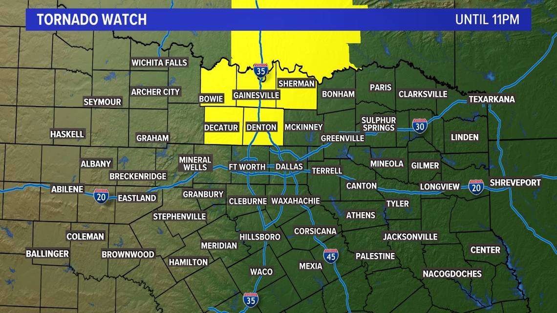
Tornado Warning
A Tornado Watch is in effect for northern North Texas until 11 p.m. It does include Denton County in the DFW area. Storms close to the Red River are severe with a threat for tornadoes, hail, and damaging winds.
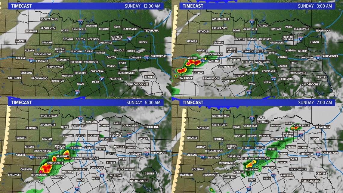
Another round of storms may sweep across parts of North Texas during the early morning hours of Sunday. While there could be some instances of hail or gusty winds, the overall severe threat is low.


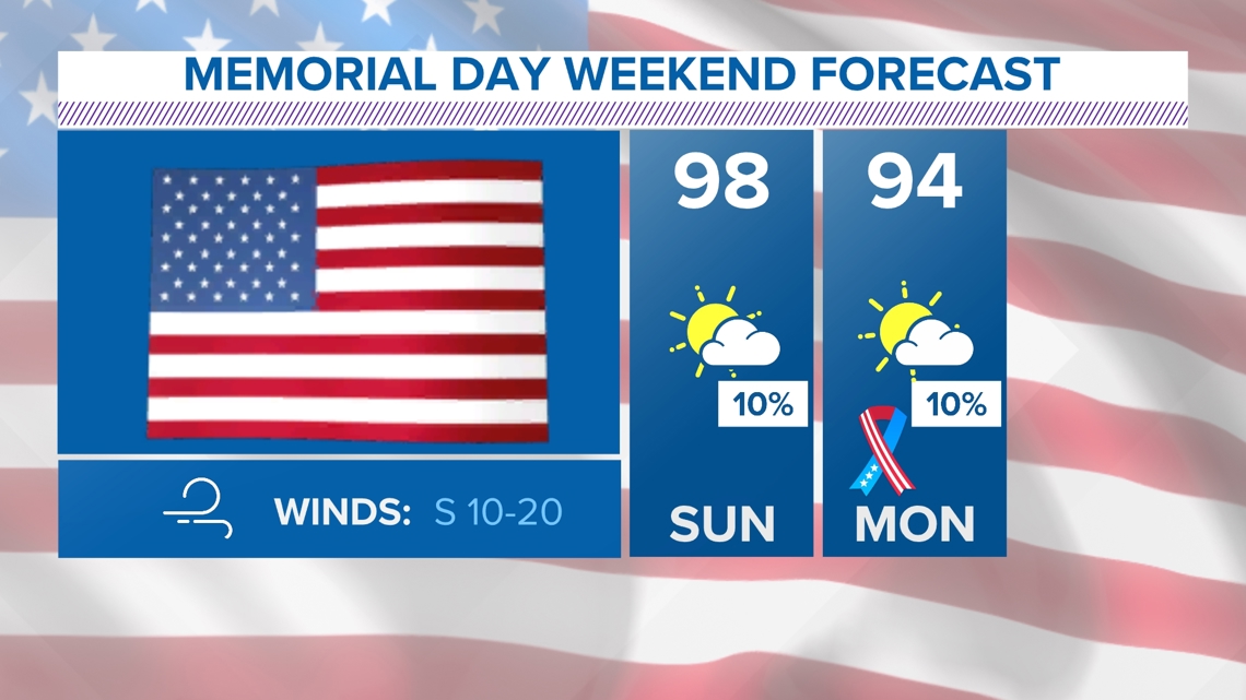
Warm Memorial Day Weekend
Memorial Day Weekend will be feeling A LOT like summer.
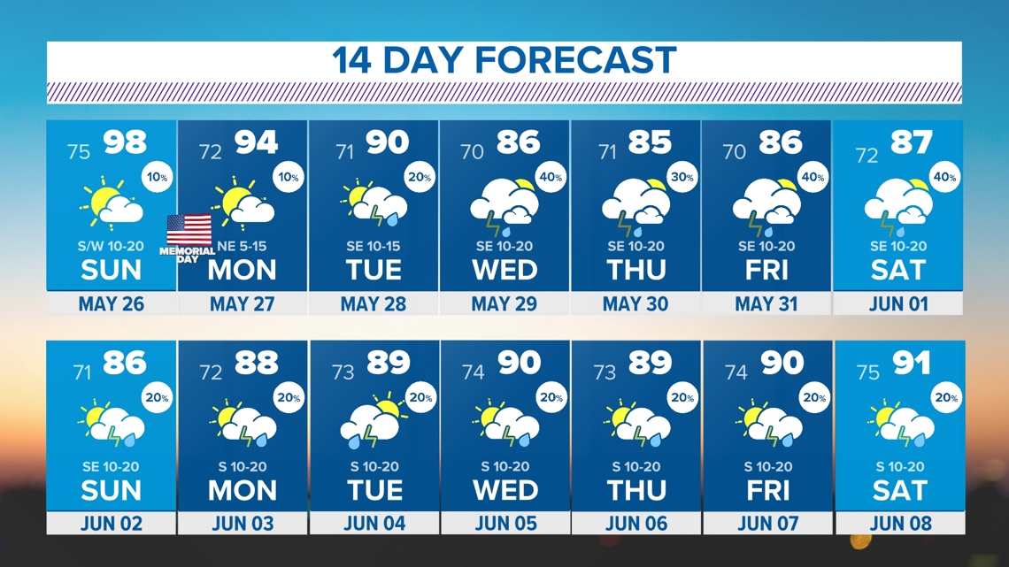
Did you see Sunday? Actual temperatures get close to the triple digits with heat index values easily over 100° for most. A front will come in late Sunday into Monday. It’ll help knock temps down to the low 90s with slightly lower humidity.

Sunday’s storms
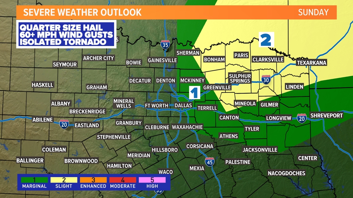
The severe weather threat is much lower on Sunday for North Texas. Storm coverage will also be low. A cap will be in place that will likely limit storm development. IF a storm can form, it would most likely be across eastern and northeastern North Texas.
If storms develop, up to quarter-size hail will be the main concern for northeast North Texas.

14 Day Forecast
Rain and storm chances increase to end May and as we head into June. What has already been a rainy spring looks to continue.