Heat advisories are back for much of the area. Rain chances return this week, too.
DALLAS — Be sure to download the WFAA app to track the latest forecast and get alerts from our team.
High heat is coming back. Here’s the latest forecast:
Versión en Español: ¡Prepárese para un clima más seco y cálido durante la semana y el fin de semana!
Quick Notes:
- Return of the 100s
- A cold front not far behind
- Scattered thunderstorms return
100° Heat Makes A Return
This summer has obviously had its share of hot spells, but overall… it’s been fairly tame. ESPECIALLY compared to the last two summers.
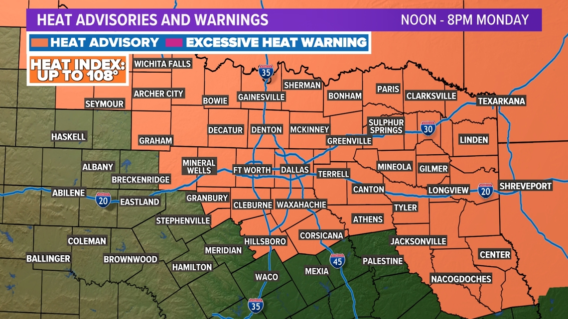
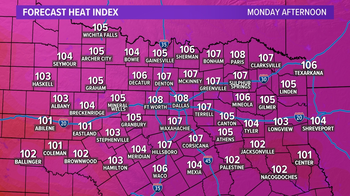
On Monday, the 100° heat is back. Add in humidity to that equation and we’re looking at heat index values between 105° and 108°. For that reason, a heat advisory has been issued for the area.


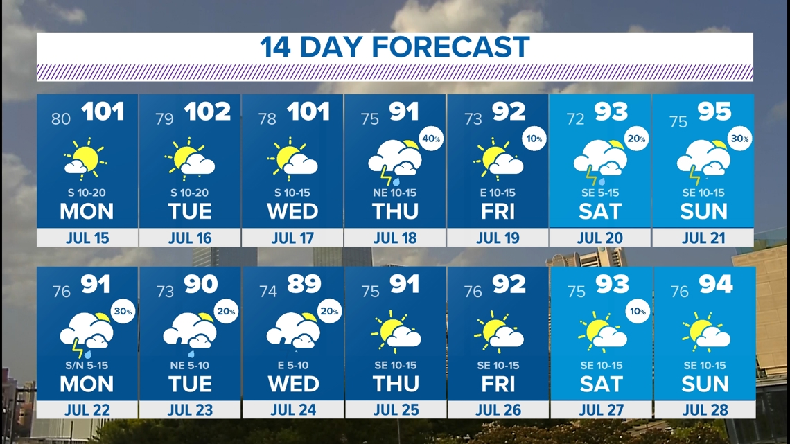
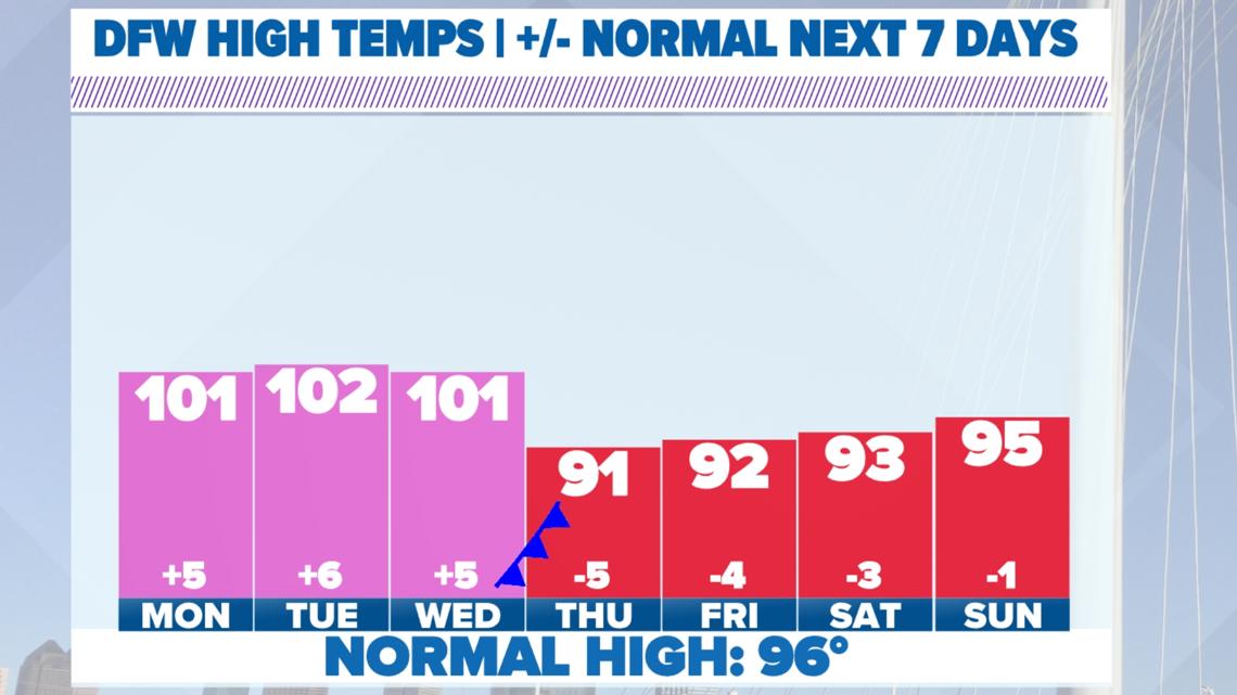
High heat will continue for a few days this week until a cold front sweeps in. The timing of this will have a huge impact on the forecast high for Wednesday, but at this time, it looks to move in late enough Wednesday into Thursday to keep highs around 100 Wednesday afternoon. Behind the front will be highs in the lower 90s for several days. That’s great for this time of the year.

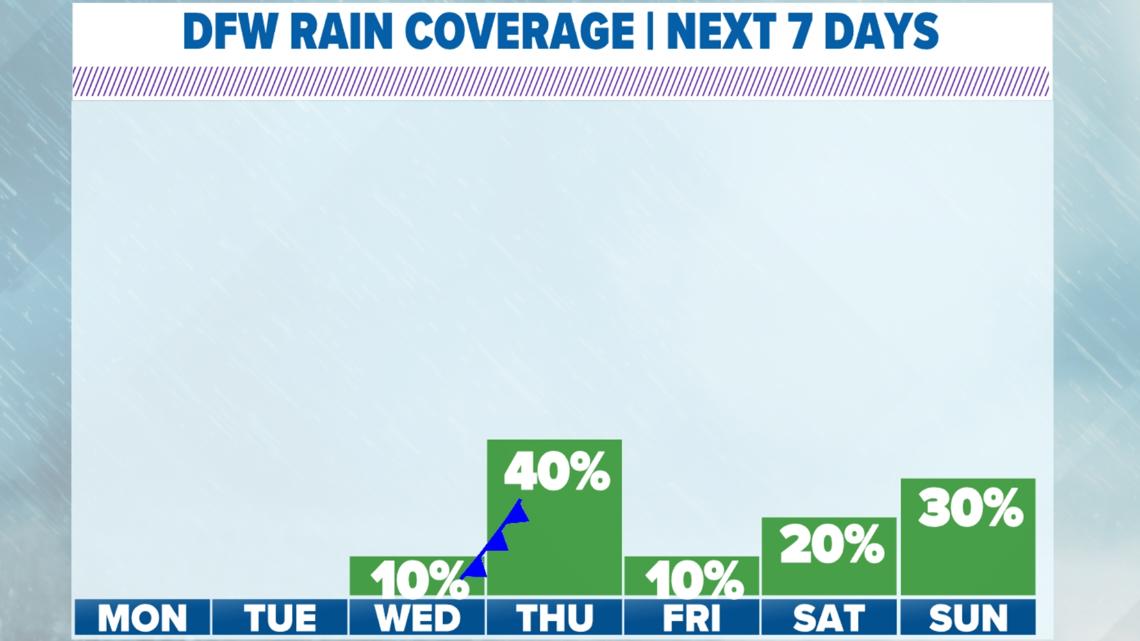
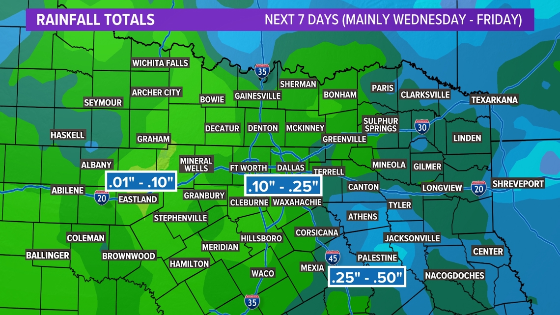
Rain Chances Return
When the cold front gets into North Texas Wednesday night or early Thursday, it will drag scattered showers and storms chances in with it. Severe weather is not expected, but pockets of heavy rain are expected. Unfortunately, not everyone will see rain with this as the activity will be scattered. More rain chances will come back next weekend.


14-day forecast
Overall, it’s not too bad for the middle of July! We have a second cold front that comes in after next weekend. That will keep temperatures down in the lower 90s. Of course, changes are possible, so check back for the latest!