Temps will be close to normal for the rest of the week, but very cold air will arrive next week.
DALLAS — Watch live radar and forecast updates on WFAA+ and download the WFAA app for alerts from our team.
Key takeaways:
- Cool and dry for NYE
- Near-normal temps through Sunday
- Rain Sunday followed by arctic air next week
New Year’s Eve
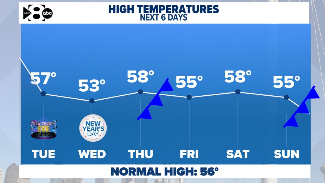
After a very warm Monday (DFW hit 82°!), cooler and drier weather has settled in across North Texas. Temperatures this week will feel much more like winter, with highs in the 50s and chilly nights dipping into the 30s.
If you’re celebrating tonight, expect temperatures in the low to mid-40s around midnight—chilly but typical for this time of year. So, grab a coat and toast the new year!


What to expect this week
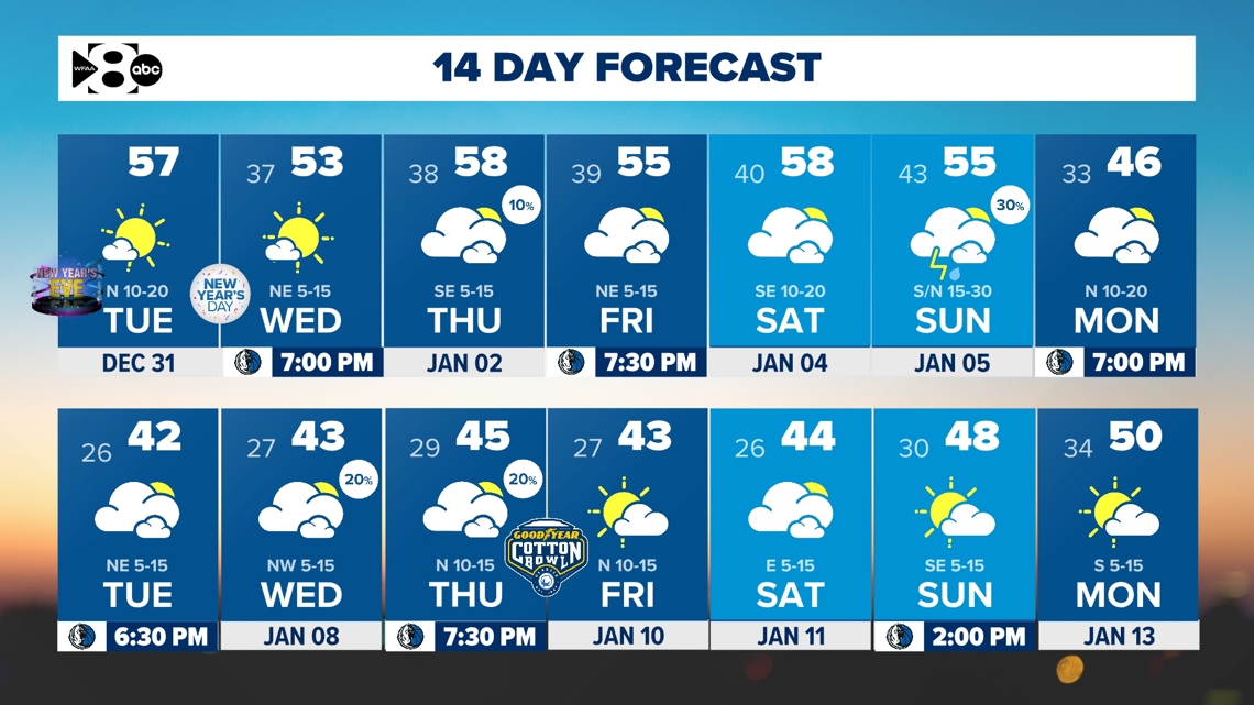
The dry, seasonable weather sticks around through Saturday, with more sunshine and highs in the 50s. Lows will hover in the 30s most nights, and some rural areas could even dip below freezing. Sunday’s temperatures should be near-normal, but that is when our next strong cold front arrives.


Arctic air returns next week
Sunday rain?
A strong cold front is set to arrive on Sunday, bringing a chance for showers and even a few thunderstorms. The severe weather potential is uncertain, but as of now, it does look like we could see a few thunderstorms, especially east of DFW. Severe weather isn’t guaranteed, we’ll keep an eye on it as the system develops.
Arctic Air Incoming:
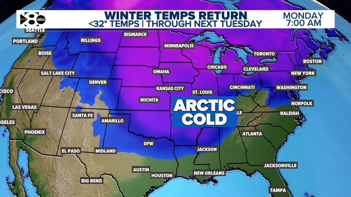
It is looking more and more likely that arctic air will move in early next week, potentially making it the coldest stretch of the season so far.
- How cold? It’s still uncertain, but highs could range from the 40s to 50s, depending on how the Arctic air settles. Lows might dip into the twenties in some spots!
- Wintry weather? While it’s too early to say for sure, there’s no clear indication of frozen precipitation just yet. The chance for that looks to stay north.


14 Day
Enjoy this week’s calm, seasonable weather while keeping an eye on next week’s forecast. Arctic air could bring some serious chill. We’ll continue to monitor the data and adjust the forecast as we get closer.

