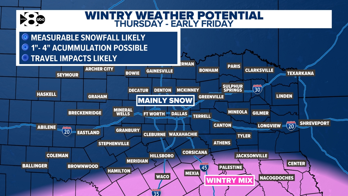
A storm system could bring accumulating snow for the end of the week.
DALLAS — Thursday and Friday are WFAA Weather Alert Days.
This is because of the potential for accumulating snow. A storm system could bring widespread 1″ to 4″ of snow for the end of the week. Morning lows will be in the 20s with afternoon highs reaching just above freezing. Prepare for hazardous driving and don’t forget the “4 Ps!” People. Pets. Pipes. Plants.
WHEN
Thursday morning through Friday afternoon
Snow flurries start as early as late Wednesday night with little to no accumulation. Snow accumulations will be likely through the day Thursday with wintry precipitation ending through Friday morning.
IMPACT
Accumulating snow is likely for the end of the week. Snow is likely for all of North Texas. A snow, sleet and rain mix is more likely for Central Texas. Temperatures will be sub-freezing each night this week. Afternoon highs will be just above freezing, in the 30s, each afternoon.


NEED
The “4 Ps!” People. Pets. Pipes. Plants.
Now is the time to make sure you and your loved ones have a place and a way to stay warm during this cold snap. Same with your furry friends!
You also have time to make sure your pipes are properly protected. While this cold is not expected to be “pipe bursting,” because we anticipate getting above freezing each day, it’s best to just get things tidied up to be safe. And don’t forget to turn off your sprinklers!
Prepare for hazardous travel Thursday through Friday. Take your time if you have to be on the roads.
Stay updated on the forecast. The timing, snowfall amounts and impacts will be fine tuned as we gather more data in the days to come.