The mornings will still be cold, but afternoon highs in the 50s will provide relief!
DALLAS — Watch live radar and forecast updates on the WFAA+ streaming app and download the WFAA app for alerts from our team
Key Takeaways
- Another freeze on Friday morning
- A gradual warmup brings highs closer to normal
- Rain and storm chances return this weekend and next week
Cold mornings stick around
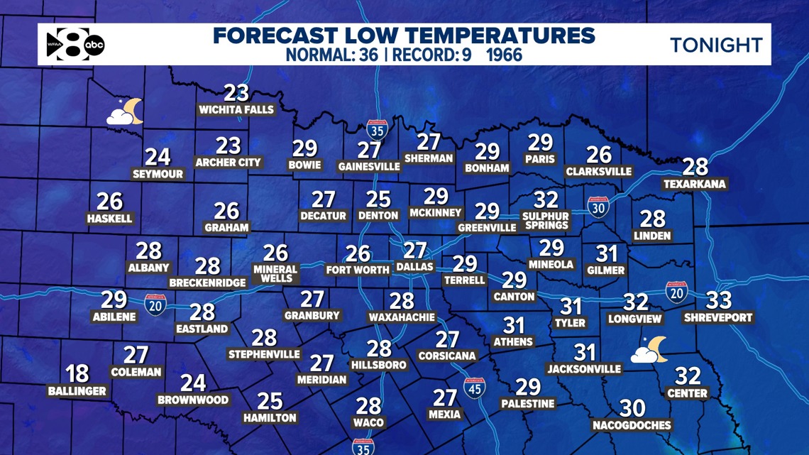
Friday morning lows will drop back to below freezing, with temperatures bottoming out in the 20s under clear skies. Winds from the north at 5-10 mph will keep wind chills manageable, but you’ll still want to bundle up.


Warmup through Saturday
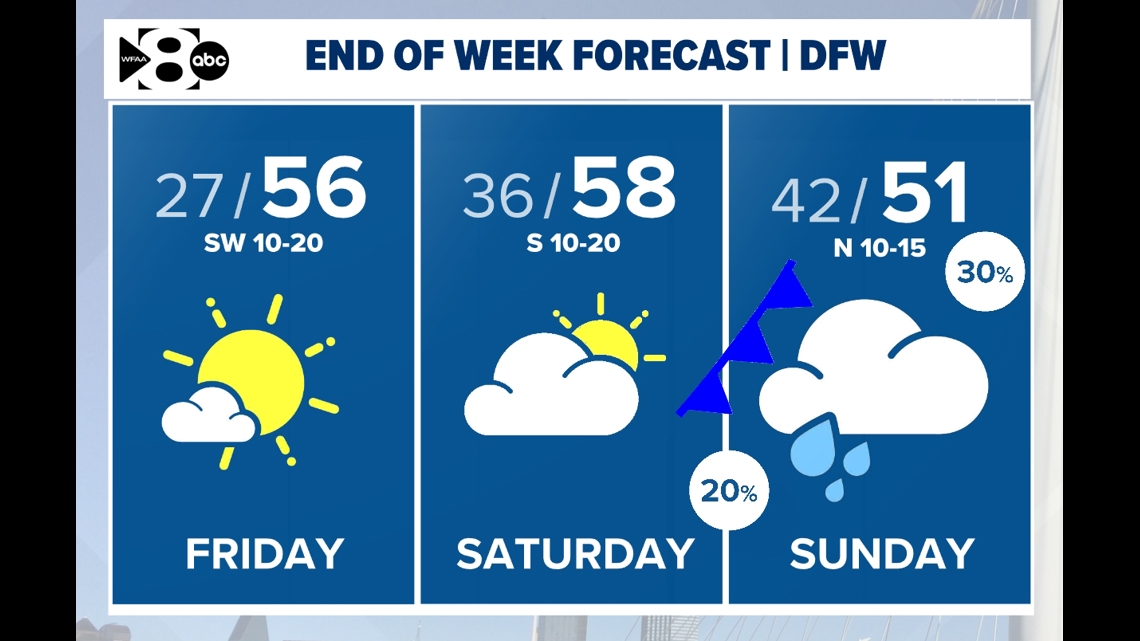
On Friday afternoon, expect breezy southwest winds (10-15 mph with gusts up to 20 mph). This will bring highs to near-normal making it the warmest day in about a week. South/southwesterly winds will increase humidity and cloud cover on Saturday ahead of the next cold front. Highs on Saturday will reach the upper 50s to low 60s.


Weekend rain chances
A cold front arrives Saturday night, bringing scattered showers and a few thunderstorms, mainly along and east of I-35. Rain will continue into Sunday as the cold front pushes through, dropping highs back into the 40s and low 50s. While severe weather is not expected, thunderstorms will be possible on Sunday.
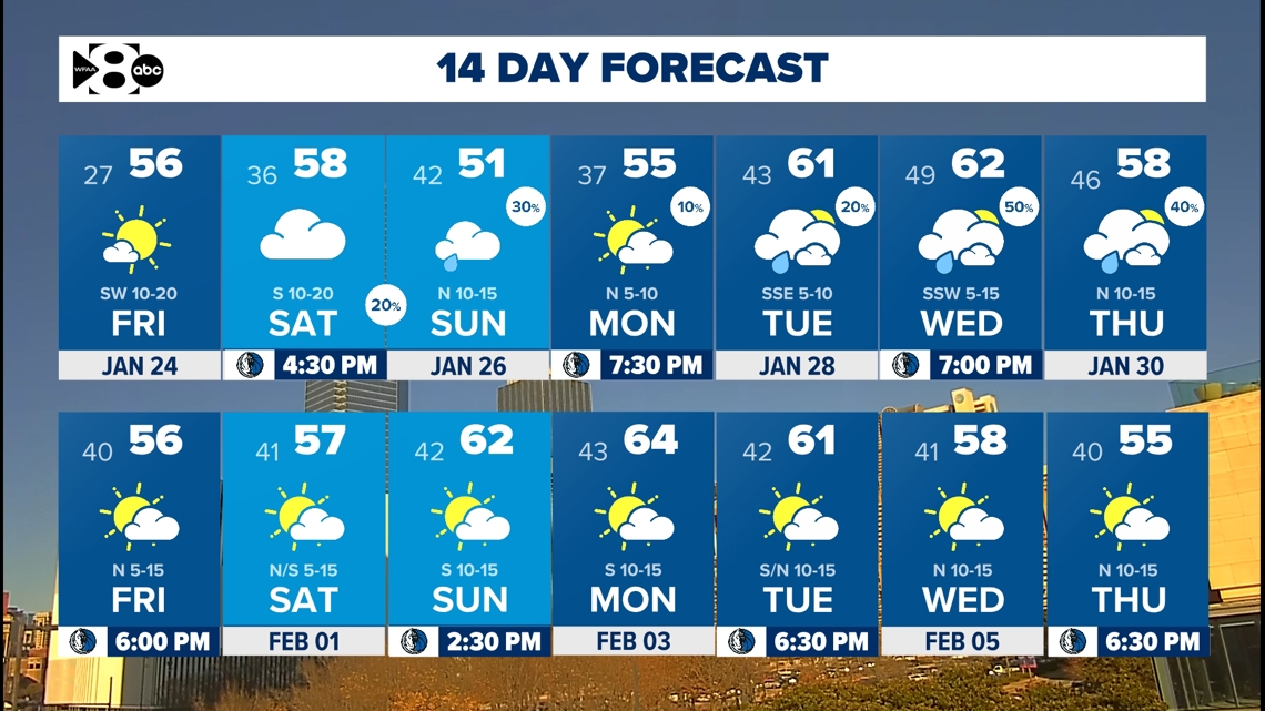
Unsettled pattern next week
Monday and Tuesday look mostly dry, but cloudy as moisture keeps coming in from the Gulf. Another round of rain and storms is possible starting Wednesday as the next system approaches. While the timing of rain could still change, this system could bring widespread rainfall. Keep checking in!

