Scattered rain begins Tuesday night with the heaviest rain arriving by Thursday morning.
DALLAS — Watch live radar and forecast updates on the WFAA+ streaming app and download the WFAA app for alerts from our team.
An unsettled weather pattern will take shape this week with multiple rounds of rain and/or storms expected. Thursday is a WFAA Weather Alert Day.
Key Takeaways:
- Showers and storms are expected from Tuesday night through Thursday, with rainfall totals ranging from 1-3 inches, and isolated areas receiving more.
- Heavy rainfall Wednesday night into Thursday may lead to localized flooding with isolated strong or severe thunderstorms possible, mainly south of North Texas
- Drier Friday and weekend with warmer weather
The system coming in will be the same one that brought much-needed rain to Southern California after the recent wildfires. For us, it’s delivering some showers, a few storms, and a temperature rollercoaster. Let’s break it down day by day.
Today (Tuesday):
Expect a quiet, mild day with overcast skies and highs in the upper 50s to mid-60s. The light rain or drizzle earlier in the day has mostly moved out.
Tonight into Wednesday morning:
Temperatures won’t drop much since we have a decent amount of cloud cover. More moisture moves in to increase scattered showers. We may even see some fog forming. Warm, humid conditions will lead to scattered showers with a few isolated, non-severe thunderstorms.
Wednesday afternoon:
It’ll be a cloudy day with scattered, light rain and highs in the 60s. A few isolated thunderstorms will be possible with a low threat of severe weather.
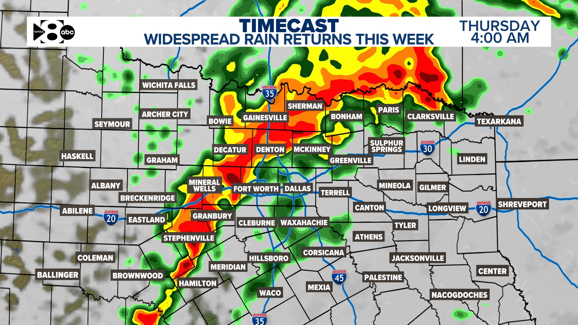
Wednesday night and Thursday: Better, more widespread rain chances return
As a slow-moving upper-level low treks toward Texas, expect rain chances to pick up again. Showers and isolated storms are possible Wednesday through Thursday with the possibility of low-end severe weather Thursday morning. If you have any outdoor plans ESPECIALLY Thursday… make sure you start thinking of a back up.
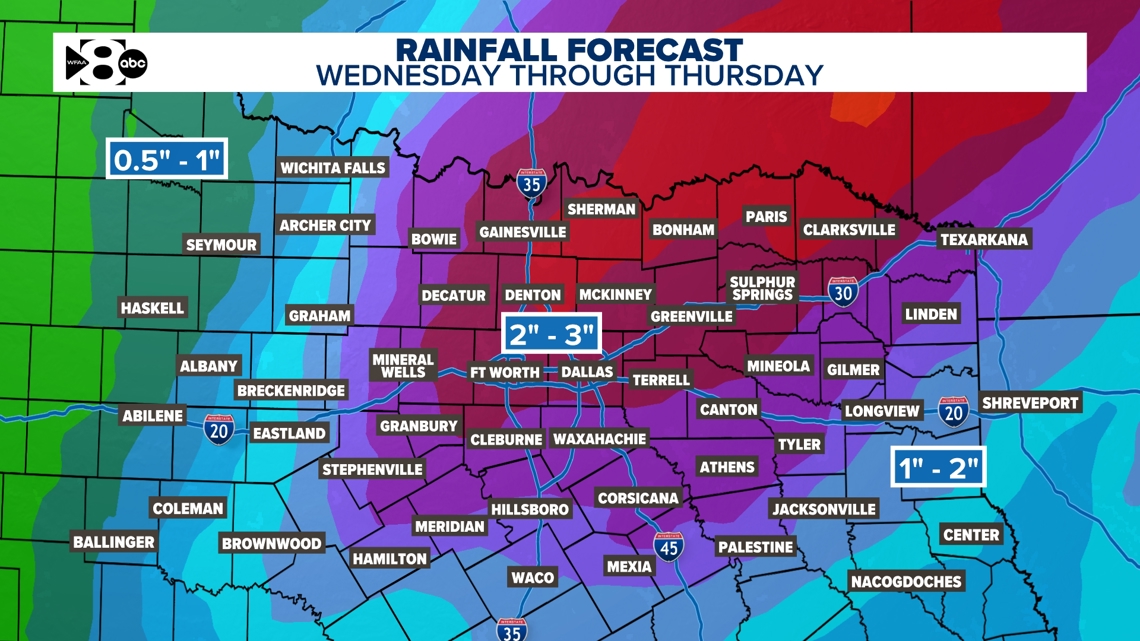
- Rain Chances: Showers and storms will become more widespread Wednesday night into Thursday morning, with 1-3 inches of rain likely. Isolated areas could receive more.
- Flood Risk: Heavy downpours and training storms may lead to localized flooding.
- Severe Weather Outlook:
- Wednesday night – Thursday morning: Marginal risk (Level 1 of 5) for a few strong storms.
- Damaging winds up to 60 mph’
- Hail up to quarter-size
Timing:The heaviest rain and strongest storms will likely occur Wednesday night into early Thursday afternoon.
Thursday night: Rain and storms will end quickly as the Pacific front moves through, bringing slightly cooler and drier air.
Weekend weather: Expect a drier pattern with above-normal temperatures and additional warming by early next week.
Looking Ahead: Uncertainty in the forecast
While we know the weather will stay unsettled, the exact track and speed of the upper-level low remains uncertain. Depending on its placement and timing, rain amounts could vary significantly. Some models suggest widespread rainfall of up to 2-3 inches, while others suggest much less. We’re currently leaning toward the wetter solutions with 2-3 inches total expected for many through Thursday. So this is not just one day… it’s an accumulation over several days. The highest totals are shifting toward the metroplex and northeast.

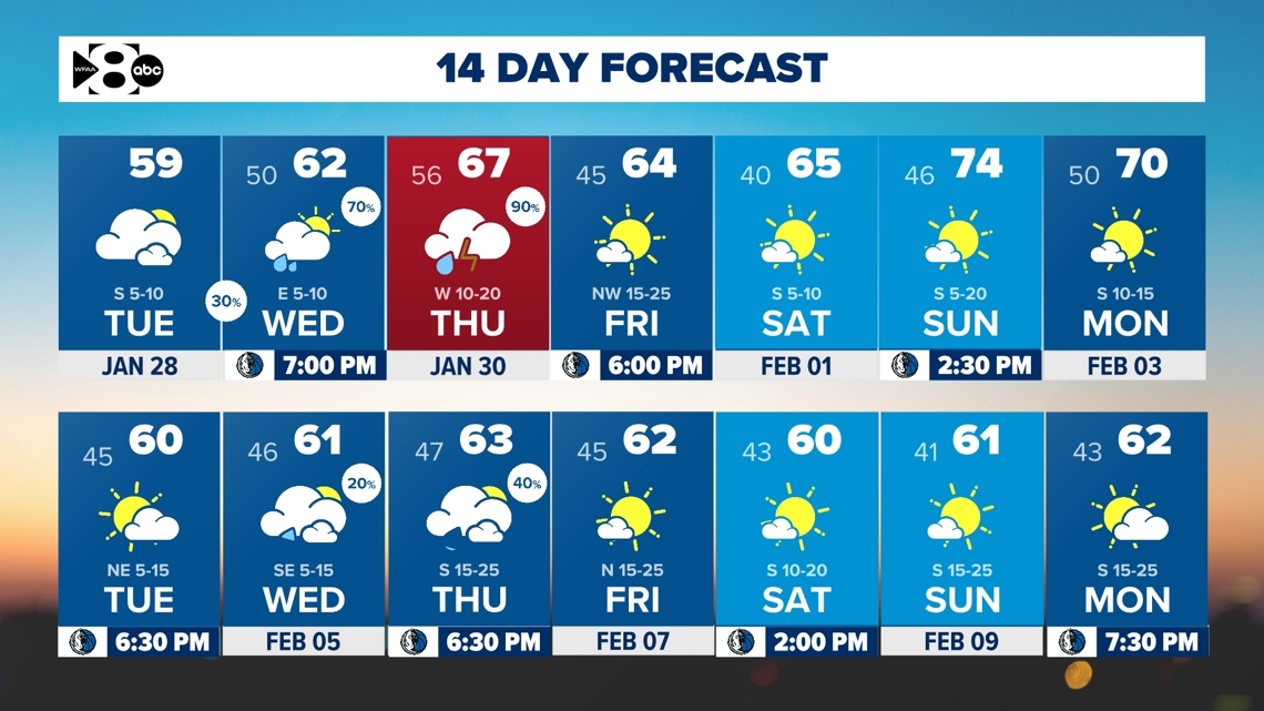
14-day forecast
Stay tuned to WFAA for updates as we monitor this evolving weather situation. Keep your umbrella handy and stay weather-aware, especially Wednesday night through Thursday!