After a chilly weekend, the workweek turns much warmer with a chance of storms
DALLAS — We’re tracking the latest forecast and weather updates on the WFAA+ streaming app. Don’t have WFAA+? Here’s how to download and install the app on your smart TV.
Key takeaways
- A cold Monday morning
- Nice, warmer and drier week ahead.
- A few storms are possible Wednesday
A cold start to the workweek
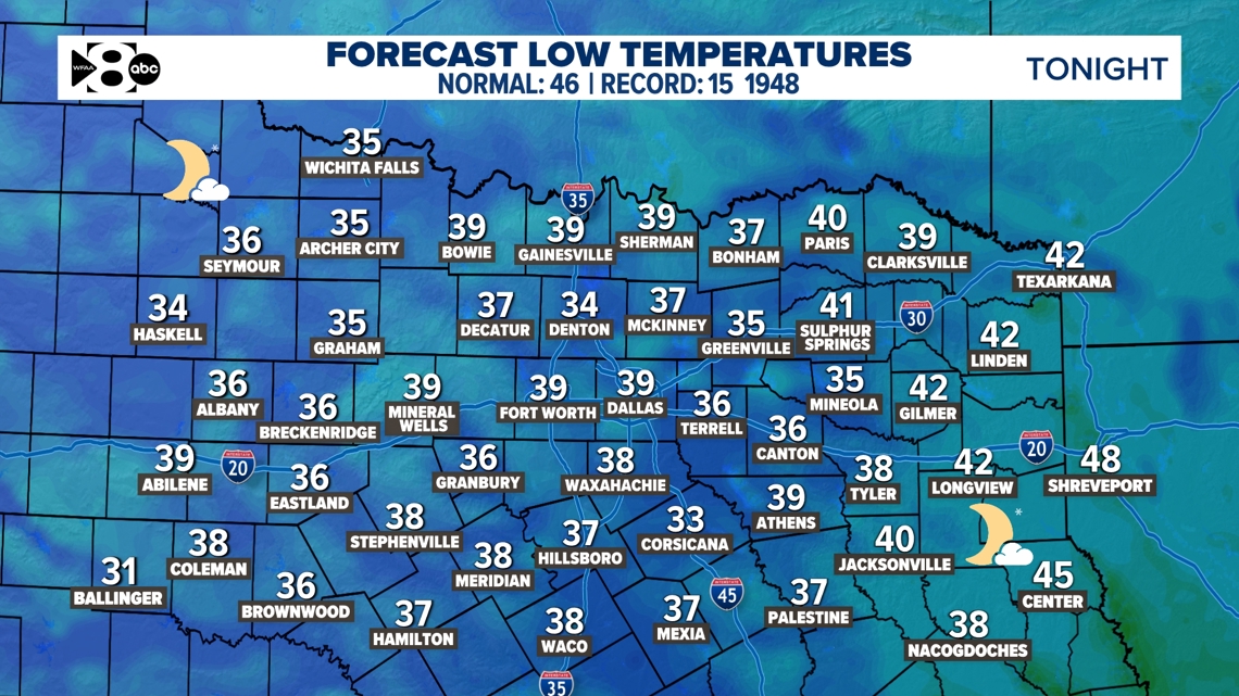
Bundle up Monday morning! It won’t be a freeze, but temps will fall into the 30s early Monday morning. There could also be a little patchy fog especially east of the metroplex.

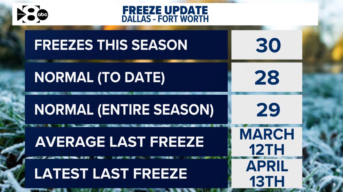
Speaking of cold and freezes, the average last freeze is this Wednesday, and we have no freezes in the forecast over the next two weeks. It’s not impossible to see one more freeze because we’ve had one as late as April 13, but the odds look really low at this point.

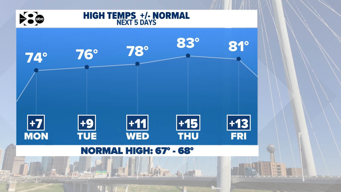
Spring-like warmth comes back fast
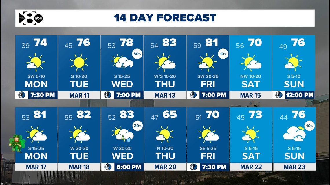
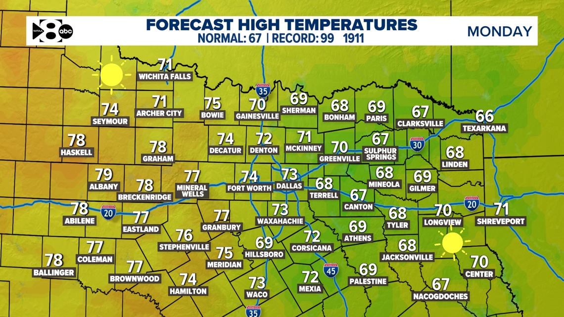
After a chilly weekend, the spring-like warmth and above normal temperatures return for the workweek. Highs even jump into the 80s before the week is over. After the cold morning mentioned above, highs jump into the 70s for a large chunk of North Texas Monday afternoon.


Our next chance of rain
Much of the upcoming two weeks looks quiet relative to this time of the year. Our next chance for rain and a few thunderstorms looks to move through on Wednesday in the form of a quick moving disturbance. This one doesn’t look to be particularly strong, so the coverage is expected to remain low and the severe weather threat looks very low as well.
14-day forecast
The next two weeks look warmer than normal and drier than normal, overall. Lots of pleasant weather to get outside and enjoy!