Here’s how a potential tropical storm or hurricane could impact Texas.
TEXAS, USA —
We are keeping an eye on the Gulf of Mexico this weekend and certainly into next week.
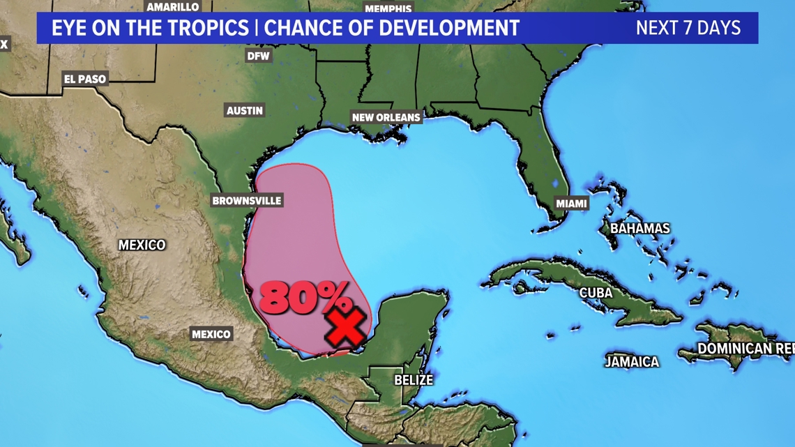
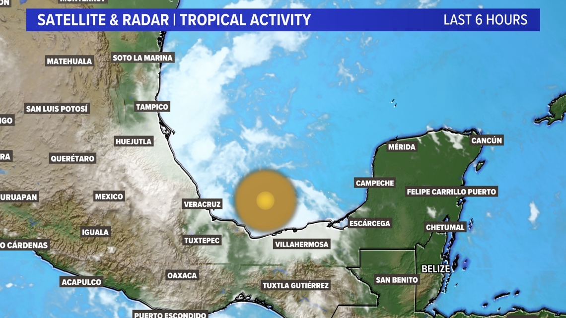
In the southwestern Gulf of Mexico, there’s a tropical wave with a 80% chance of developing over the next week.


While the area of unsettled weather won’t be in the most perfect conditions to strengthen rapidly, there’s enough in place that “Francine” could form sometime next week. Will it be a tropical storm? A hurricane? Too soon to tell, really. But we’re monitoring it closely.


A tropical depression might form early to mid-next week as the system moves slowly northwest to north over the southwestern Gulf of Mexico. And again, where it goes from there is too soon to call. A major hurricane is extremely unlikely.
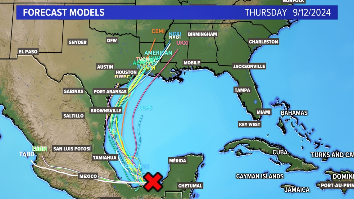
It’s still too early to predict the exact path of potential “Francine.” However, there is surprisingly good agreement amongst many model members with bringing this near the Texas-Louisiana border by the middle of next week.


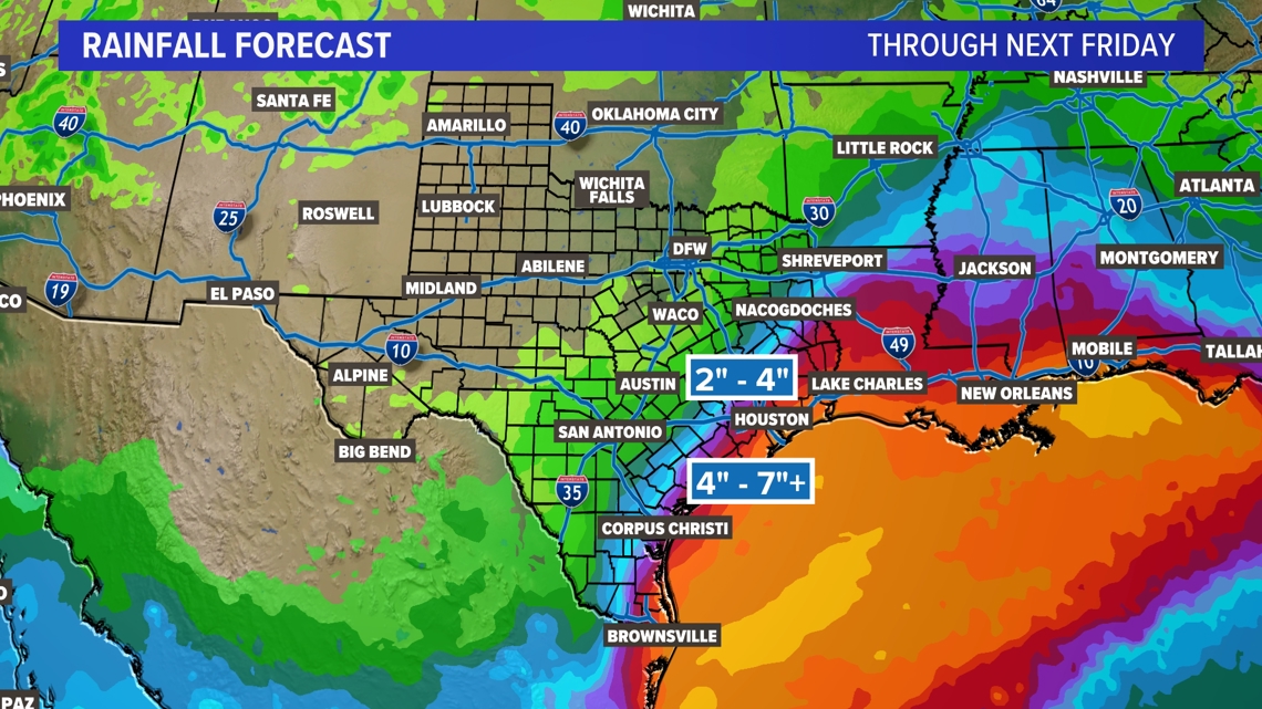
Regardless of what we end up calling this tropical disturbance, it has the potential for some decent rains in South Texas, Southeast Texas, along the coast of Texas, and even into parts of East Texas. Right now, the rain chance in North Texas from this looks slim to none. All of this could change in the days to come.


Stay tuned for updates!
Also on WFAA.com: