Very cold temperatures, hours below freezing and even a low chance of some frozen precipitation. Here’s the latest.
DALLAS — Watch live radar and forecast updates on WFAA+ and download the WFAA app for alerts from our team.
Key takeaways:
- Near-normal temps through Saturday
- Rain chances Sunday followed by plummeting temps
- Coldest temps and coldest stretch of the season so far
Rest of this week
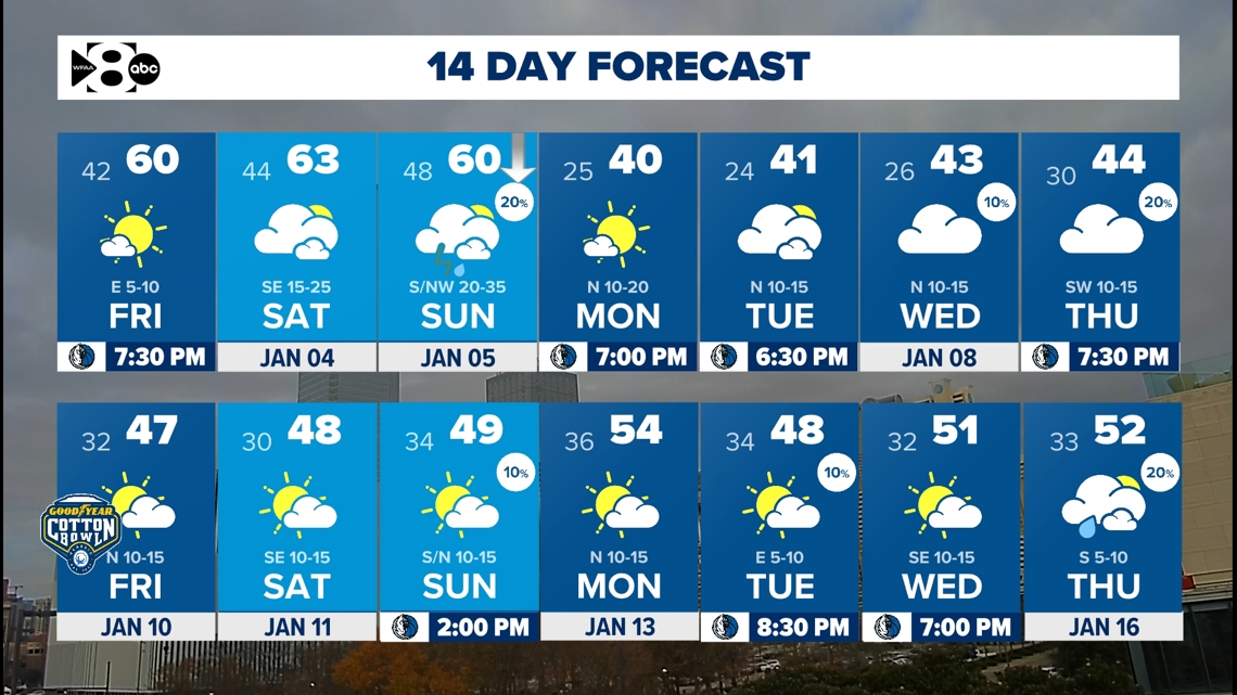
The dry, seasonable weather sticks around through Saturday, with more sunshine and highs mostly in the 50s/close to 60. Lows will hover in the 30s most nights, and some rural areas could even dip below freezing. Saturday and Sunday temps may end up being a little “warmer” in the 60s.
Then an Arctic front arrives Sunday…
Storm chances and arctic air
Sunday rain
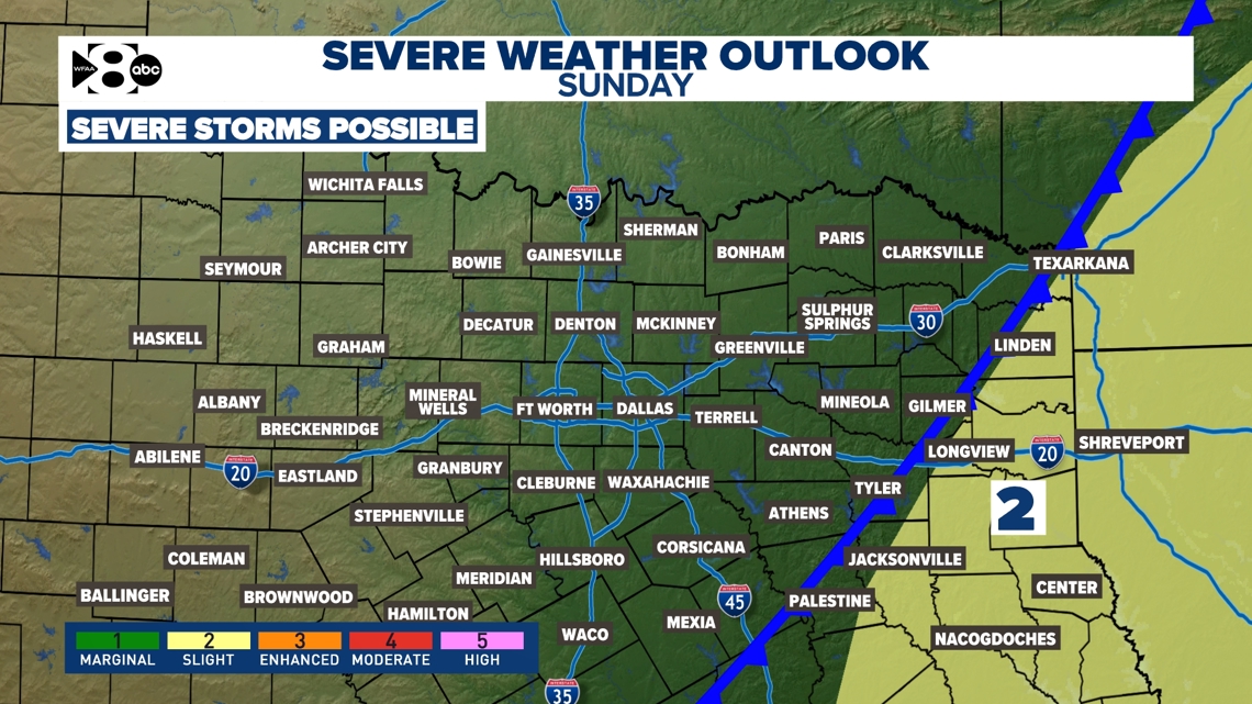
A strong, Arctic cold front will move into the area, which will bring a chance for showers and storms, especially across the eastern half of North Texas. As of now, storm chances look mostly to be in the morning with the fast-moving front and mainly for eastern North Texas into East Texas.
The severe threat also looks to be WELL east of North Texas as well. However, we’ll keep an eye on any forecast changes.

Sunday temps
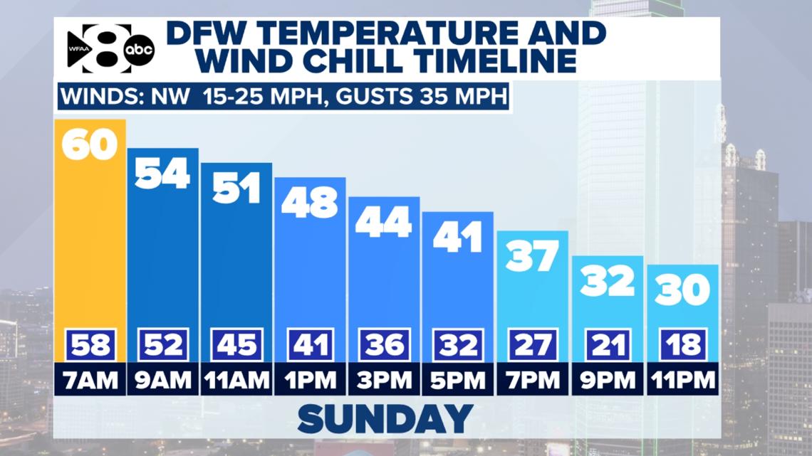
Highs on Sunday will also happen before the front passes, which for most will be early Sunday (before noon). The 60s look likely with temps quickly falling after the front passes. Sunday afternoon and evening will end up being windy and downright COLD for North Texas. Wind chills will fall into the teens before the day is over.

Arctic Air Incoming & Sticking Around:
It is looking more and more likely that Arctic air will move in early next week and stick around all week long, making it the coldest stretch of the season so far.
- How cold? A reasonable forecast is for highs in the 40s and lows in the 20s. Temps could end up being a little colder with highs closer to freezing and lows in the teens a day or two. Not guaranteed, but some areas could end up seeing colder temps. Wind chills will likely be in the low 20s and teens.
- Wintry weather? Nothing is set in stone right now, but it is not impossible for some “precipitation” in the area mid to late week. The way it looks now better chances are that it stays dry next week. However, with the cold air in place, we’ll keep a very close eye on any precipitation and winter weather mischief.
- What can you do right now? Enjoy the dry stretch of weather! If you haven’t done any winter preps for your home yet, it is a good idea to have a plan for when you are going to get that done between now and next week.
Low Temps
Have you started your hard freeze precautions yet? You have Friday and most of the weekend to get them done!
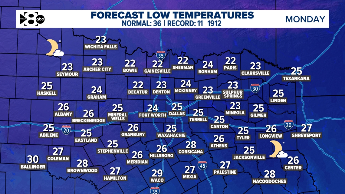
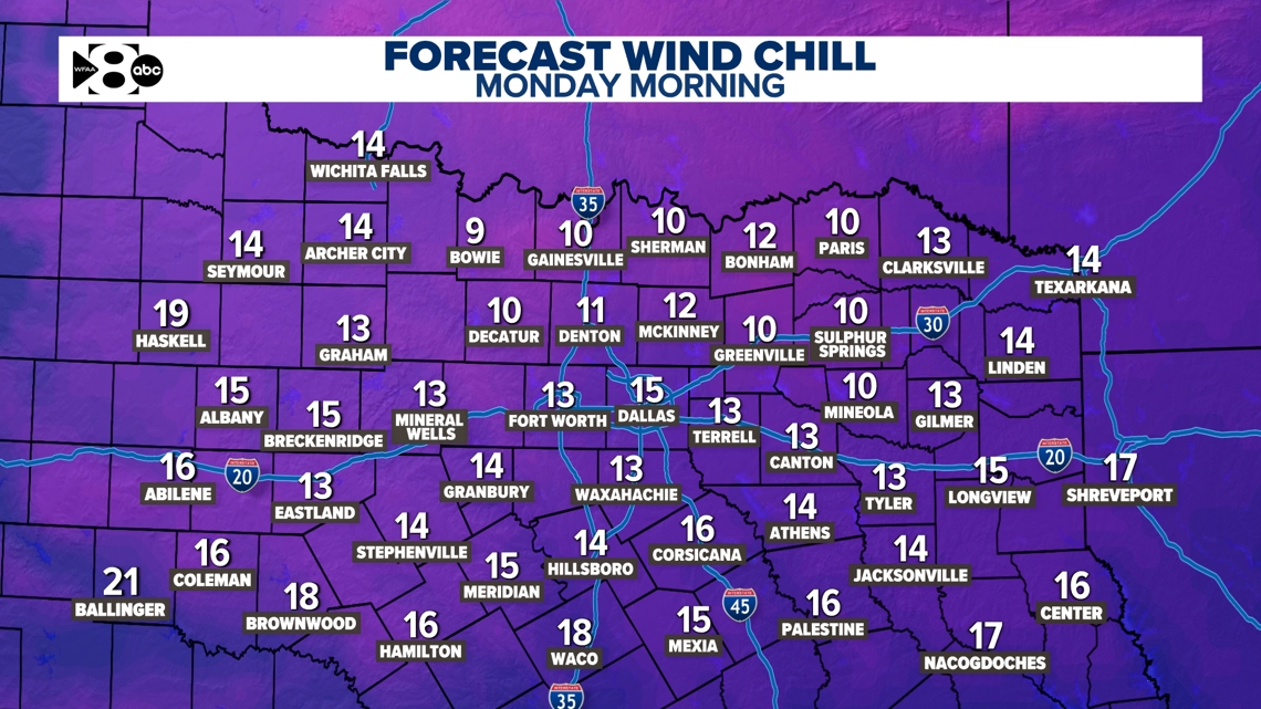
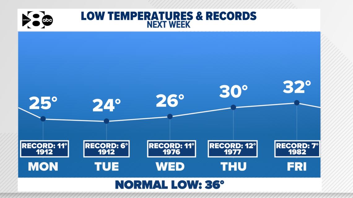
Take a look at the lows next week. Not even close to records, but COLD… Check out Monday and beyond. Lows will be in the 20s with wind chills Monday and Tuesday in the teens for everyone.



High Temps
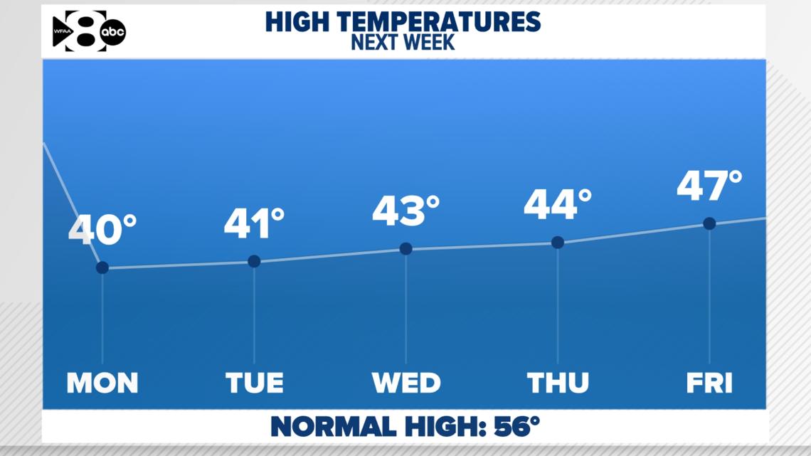
Some good news… we do get above freezing each day. That will help! So, even though each morning will be very cold with several hard freezes, the afternoons should rebound to above freezing.

14 Day
Overall, winter-like weather continues over the next 2 weeks.

