The unsettled weather pattern isn’t over yet. More thunderstorms are in the forecast this week. Some could be severe.
DALLAS — Be sure to download the WFAA app to track the latest forecast and get alerts from our team.
The unsettled weather pattern isn’t over yet for North Texas. More thunderstorms are in the forecast this week. Some could be severe. Here’s the latest forecast and timing:
Quick Notes:
- More storms to start the workweek
- Temps and humidity climb this week
- Drier forecast midweek
Live radar
Monday
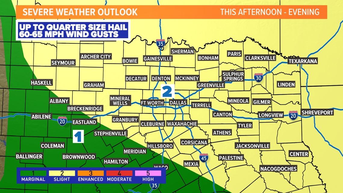
Another day, another chance for strong to severe storms. A few scattered storms will be possible at any point today, but the better-organized storms move in late afternoon and evening. Severe storms are not guaranteed for everyone, but some storms could contain up to quarter-sized hail and 60 – 65 mph w ind gusts.
Most of North Texas is in a Level 2 of 5 risk for severe storms.


Timing:
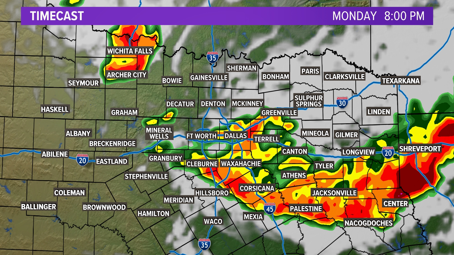
There will be two main clusters of storms to watch this afternoon and evening.
The first cluster of storms will be moving in from the north. This looks to mainly impact the eastern half of North Texas. The second cluster will come from storm development along a dryline in the Panhandle this afternoon. Ahead of these two clusters, we could see some isolated to scattered storms develop due to outflows from storms currently in Oklahoma. This will be generally low in coverage. Again, storms are not guaranteed for everyone.
Tuesday night – Wednesday morning
Another round of storms will be possible late Tuesday into Wednesday morning. As of now, it looks like this could happen after midnight until sunrise. A weak front will stall somewhere in North Texas and this helps bring added storms to the area. The timing will depend on where outflows are in the next day or so. Make sure to keep checking in!
Warm and muggy
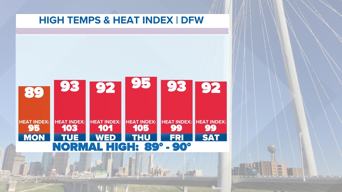
The middle part of the week will feel like summer! Temperatures will climb into the mid-90s. Southerly winds keep bringing moisture to the area. That means the heat index is back. Some heat index values will be in the 100s this week. Make sure to take heat precautions!


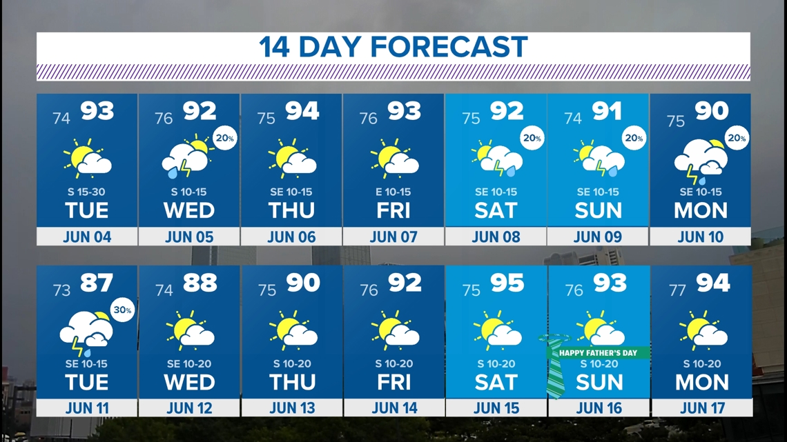
14-Day Forecast


