It’s starting to feel more like spring! Temperatures are on the climb with a few rounds of rain possible.
DALLAS — Watch live radar and forecast updates on the WFAA+ streaming app and download the WFAA app for alerts from our team.
Warmer weather is on the way, but so is a chance of rain. Here’s the latest forecast update:
Key takeaways
- Cold front arrives this afternoon
- Some scattered rain tonight
- Warmer than normal for the next couple of weeks
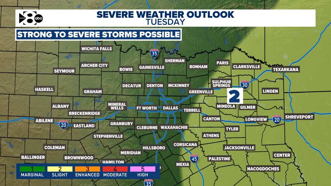
- Increasing rain chances late Sunday through Tuesday
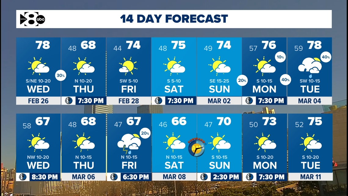
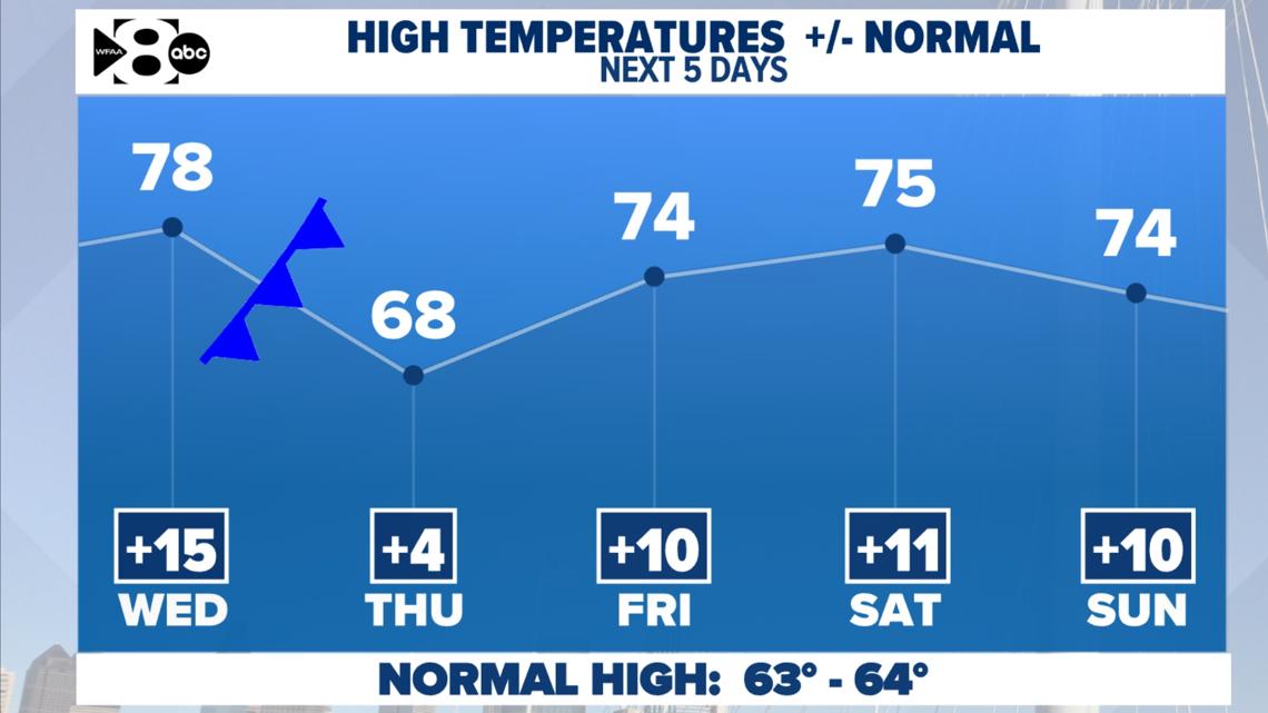
Southerly winds and an approaching cold front have our temperatures climbing to near 80 on Wednesday afternoon. Cooler, drier air filters after the front to drop our highs about ten degrees. It’ll be noticeably cooler, but nothing like last week! Temperatures rebound right back to the 70s on Friday and through the weekend. Even with the mid-week cold front, Thursday’s highs will stay at least a few degrees warmer than normal.

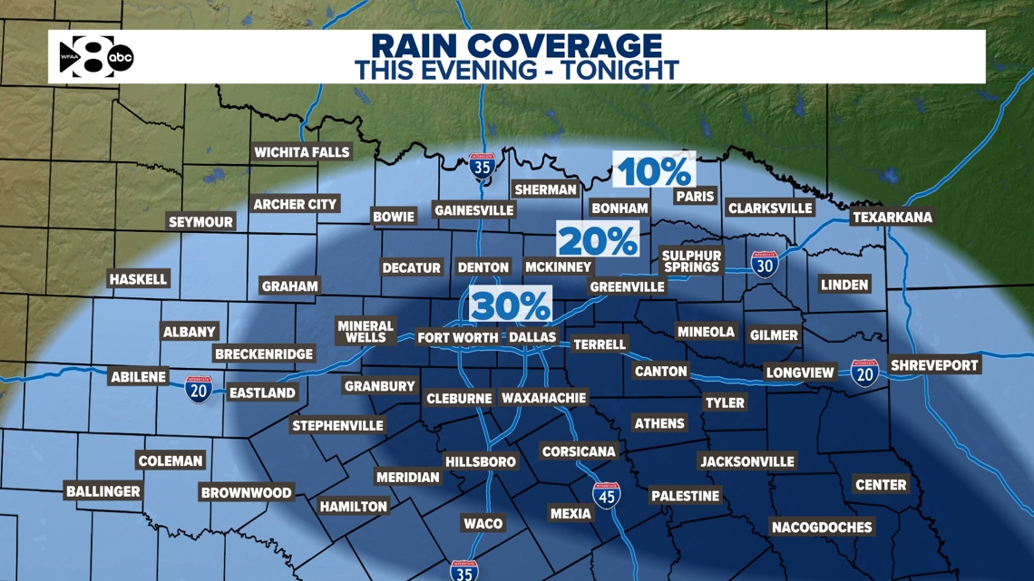
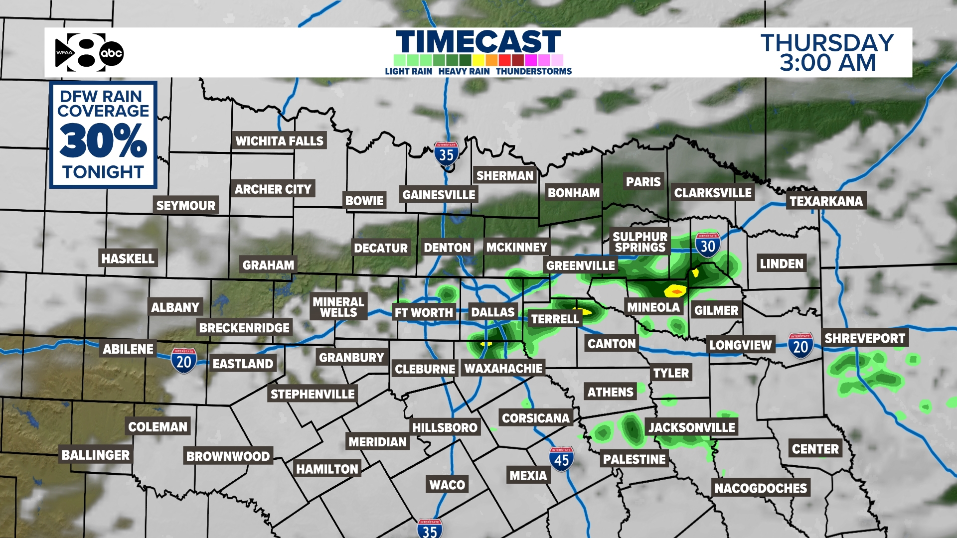
Wednesday night rain?
A midweek cold front will bring a brief break from the 70s, along with a chance for rain. It’ll be another day with highs in the 70s on Wednesday before the front moves in during the evening. While rain chances remain low at 20-30%, some scattered storms could develop behind the front, bringing brief heavy downpours and frequent lightning. The highest coverage will happen after midnight, but before sunrise on Wednesday. Behind the front, Thursday will feel noticeably cooler, with highs in the 60s and plenty of sunshine, making for a crisp and pleasant day. The 70s quickly return for the end of the week.

A couple more rounds of rain will be possible late weekend into early next week. On Sunday, thunderstorms will develop along a dryline in Oklahoma. Most of this activity will remain to the north, but a few storms could make it into northern parts of North Texas late Sunday into early Monday morning. A better opportunity for rain arrives late Monday into Tuesday morning as another system approaches. It is still too early for specifics on that one, be sure to keep checking back in. As of now, it looks like a few strong storms will be possible on Tuesday.

14-day forecast
At this time, there are no clear signs of more Arctic air over the next two weeks. In fact, temperatures will go through some ups and downs, but nothing extreme. Enjoy! Chances for thunderstorms start showing up during the first week of March. Right now, severe weather is not expected, but we will keep you updated!