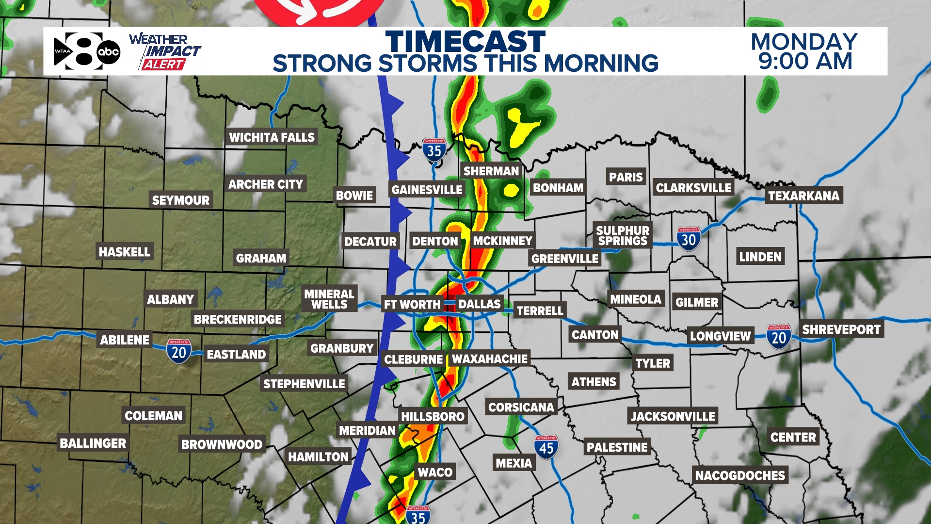
Monday is a WFAA Alert Day as a line of storms moves across North Texas during the morning. Some storms could be severe.
DALLAS — Watch live radar and forecast updates on the WFAA+ streaming app and download the WFAA app for alerts from our team
Quick headlines:
- Storm chances are highest Monday morning
- Some storms could be severe
- Stronger cold front this week
Let’s take a detailed look at what to expect with rain, storms, and severe weather through Monday.
Live Radar
WFAA Weather Alert Day
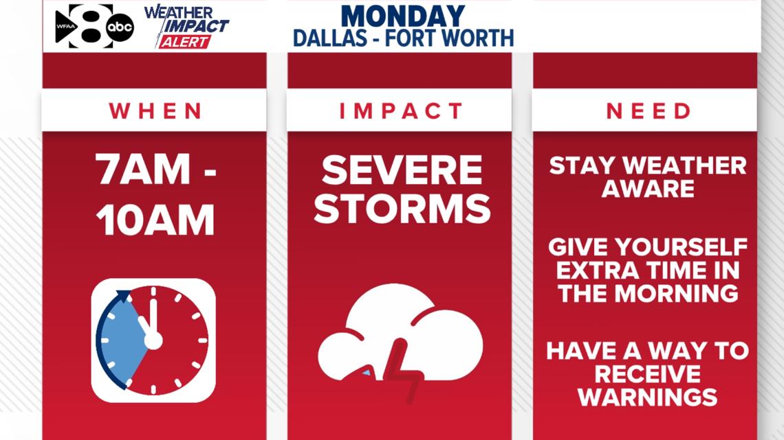
The WFAA Weather Team has declared Monday a WFAA Weather Alert Day. A line of storms will move through the DFW area during the morning hours (7 a.m. to 11 a.m.), with a chance of segments of the line of storms being severe.
Regardless of storm intensity, a round of heavy rain and lightning will be moving through the DFW area during this time. That will certainly impact the morning commute and those at bus stops or pick-up and drop-off lines.
Stay weather-aware in the morning!
Monday morning (now – noon)
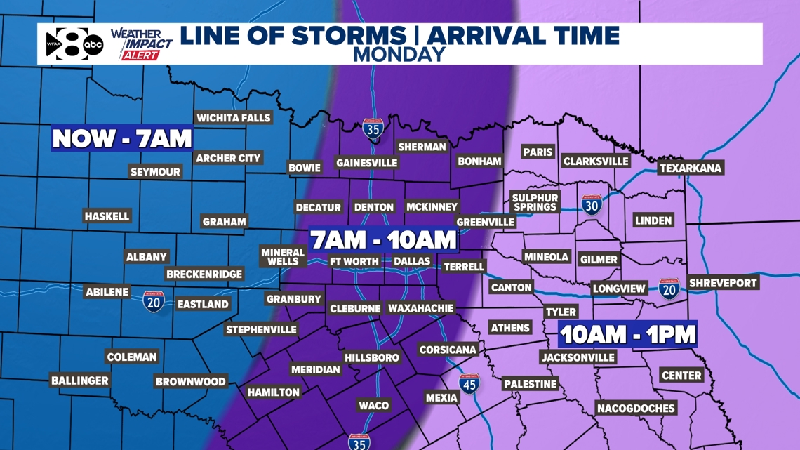
A line of showers and storms has developed to the west of DFW. That line of storms will continue to move west to east across North Texas arriving in the DFW area from around 7 a.m. to 11 a.m. Closer to 7-8 a.m. for western DFW and 9-10 a.m. for eastern DFW.
The line of storms will have heavy rain and lightning, so it will make the morning commute slow in places and make sure the kiddos are safe getting to and from school.
Storms will quickly move to the east with most of DFW dry by the late morning to noon hour. Eastern DFW will see this line of storms during the late morning into early afternoon but the severe threat looks pretty low during this time. Eastern North Texas will also clear out through the afternoon.
All of North Texas will be dry with even sunshine coming out during the afternoon into evening hours.

Severe Threat
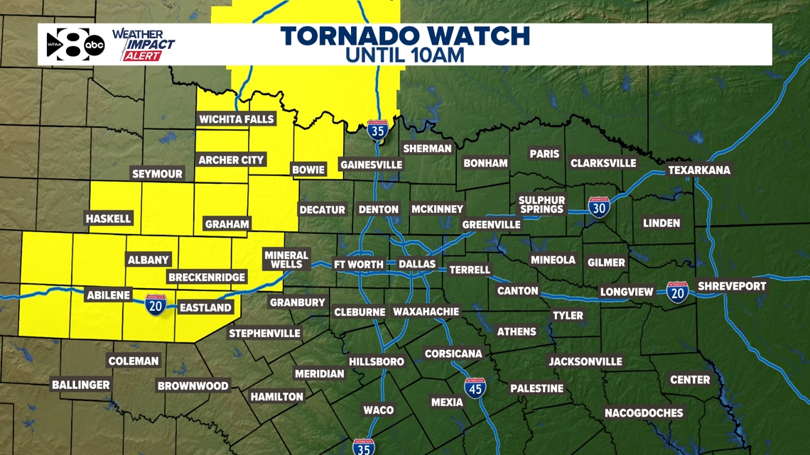
A Tornado Watch has been issued for parts of Western North Texas until 10 a.m. The developed line of showers and storms has the potential to produce brief, isolated tornadoes as it races east. In addition to heavy rainfall and frequent lightning, 60+ mph wind gusts will be possible.

TIMELINE:

Rainfall forecast
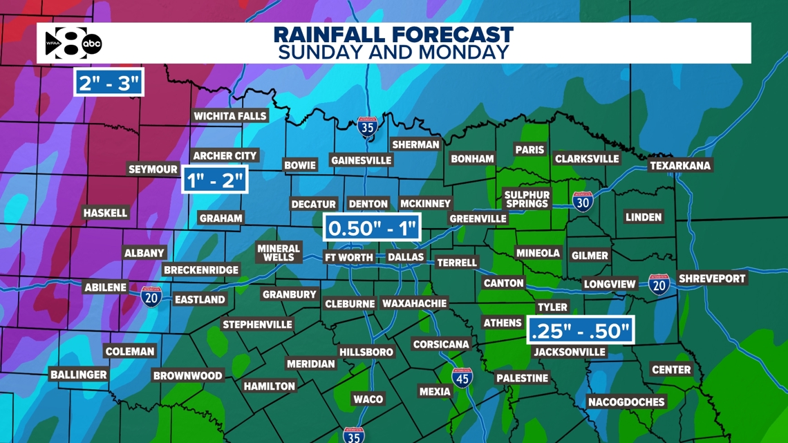
Rainfall totals look to be the highest across western and northwestern North Texas where rain was more widespread Sunday evening into Sunday night. For DFW, rainfall will mostly come from the line of storms moving through the area. Totals for DFW look to be anywhere from 1/2in. to 1in.

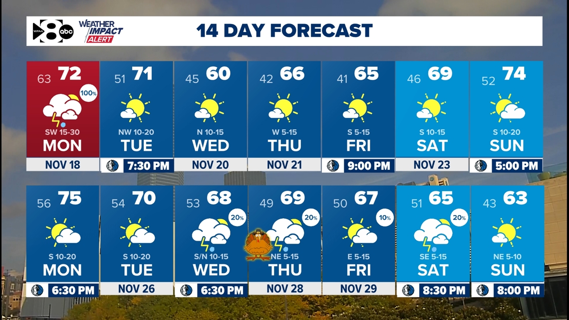
14 Day Forecast

