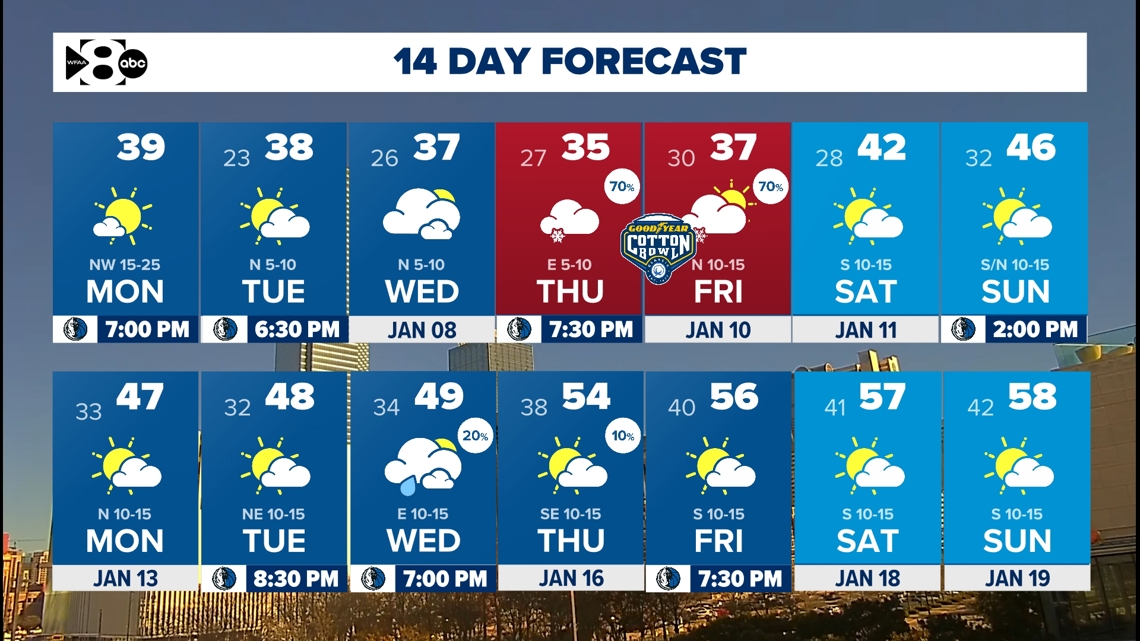
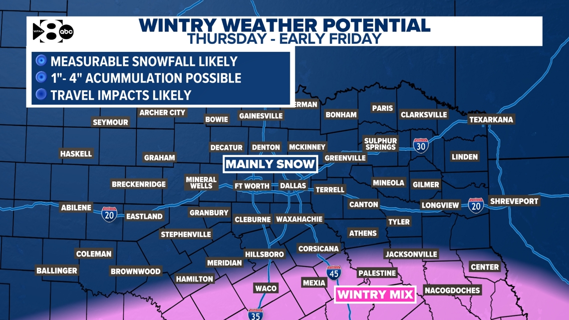
As of now, snow accumulations up to four inches look possible for North Texas.
DALLAS — Watch live radar and forecast updates on WFAA+ and download the WFAA app for alerts from our team.
Winter has arrived in North Texas. Freezing cold temperatures and the potential for snowfall are here.
We’re tracking the latest forecast updates:
Key takeaways:
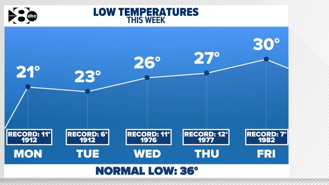
- Each night will be below-freezing this week
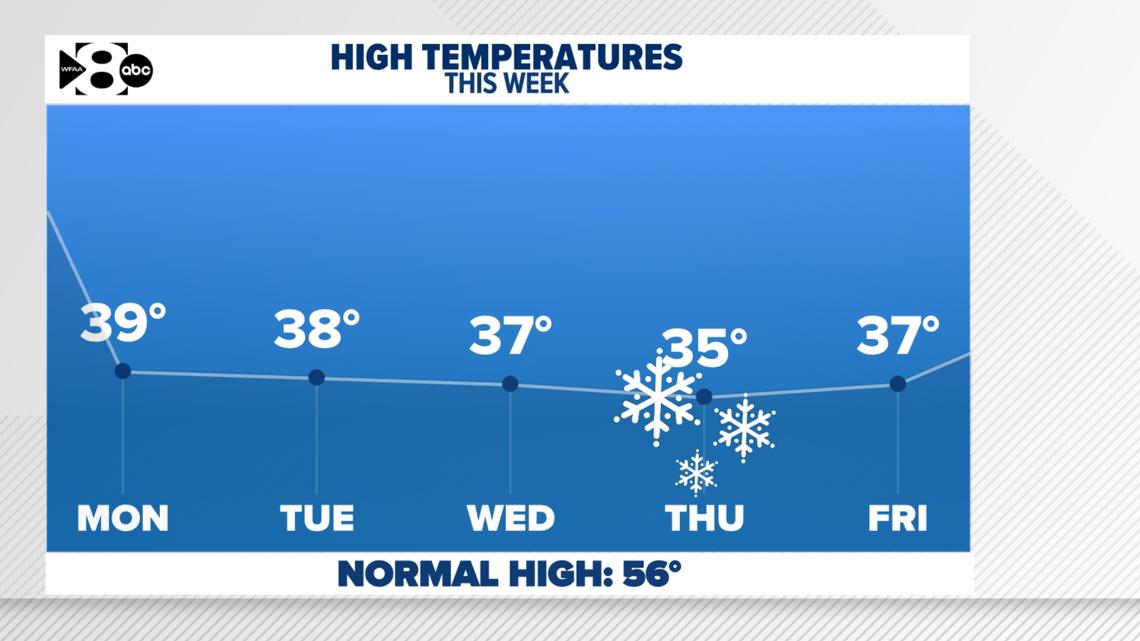
- Afternoon highs will mainly be in the 30s this week
- Wintry weather chances exist late this week
WFAA Weather Alert Days
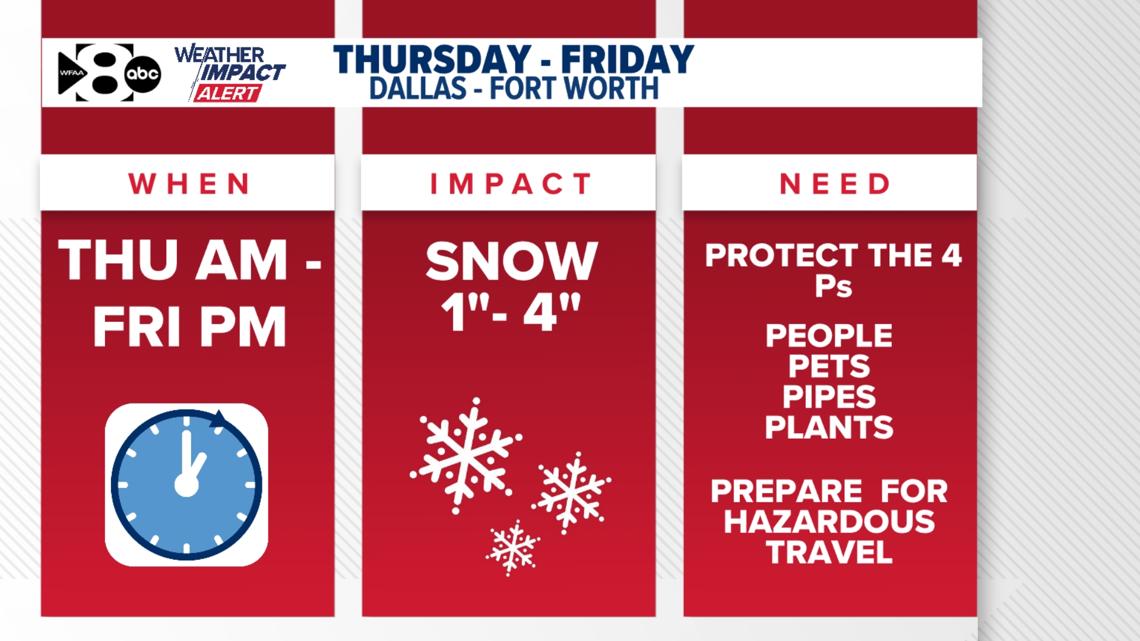
Thursday and Friday are WFAA Weather Alert Daysbecause of the snow potential early Thursday through Friday morning.

This week’s fast facts:
- How cold? Highs in the 30s and 40s with lows in the 20s. High temps each afternoon look to warm above freezing for most areas.
- Wintry weather? Not early in the week. However, late week a disturbance moving overhead will bring a chance for wintry weather (mainly snow) to North Texas. Keep checking back for updates!
- What can you do right now? Prepare your home for the cold weather and keep an eye on the forecast for Thursday and Friday. Make sure to include your pets, plants and neighbors in your cold weather plans.
Temperatures for North Texas
Take a look at the lows this week. Not even close to records, but COLD. Lows will be in the 20s with wind chills in the teens early in the week. High temperatures will be above freezing each afternoon. This will help bring at least some slight relief from the hard freezes.


Is wintry weather on the horizon? Here is the snow potential
It is likely! Do we need to panic? No. That’s never reasonable. Should you stay informed on the changes coming next week? Absolutely.
When: It is more likely that most of North Texas will see some wintry precipitation early Thursday through Friday morning. This will likely create hazardous travel on Thursday and Friday.
What: Snow for most of North Texas with some sleet/snow/rain mix for Central Texas. As of now, snow accumulations up to four inches look possible for North Texas. Forecast amounts could change as we get closer to the end of the week and more data is available.
How much snow will DFW get?
Current most likely North Texas snow amounts: widespread 1-4″, with a medium chance of 5+ inches west of DFW. Current most likely Central Texas snow amounts: 0-1″, with a small chance of 2+ inches.

Snow timeline for North Texas
Wednesday night: Some snow flurries will be possible. It’ll be very light and unlikely to accumulate.
Thursday morning: Snow showers possible. Light accumulations will begin.
Thursday afternoon: Snow showers continue. Snowfall may be heavy at times. Accumulations continue.
Thursday night: Snow will be patchy and light. Any partial melting that happened during the day could refreeze.
Friday: Snow ends from west to east in the morning. Travel impacts may continue.
Storm setup and what we are watching:
By Tuesday night, a strong weather system will move south toward Baja California, beginning the conditions for a potential snowstorm. That storm track eventually moves towards Texas. This type of system is known to bring snow to our region because it pulls in steady moisture from the Pacific Ocean while our temperatures are cold enough to sustain snow. Any difference in the temperatures and the track of this system and we could be dealing with much lower snow totals.
For snow to happen, we need three things:
- Moisture: Pacific moisture will move into our area, keeping the atmosphere ready for snow formation.
- Lift: The weather system will provide the “lift” needed to form precipitation.
- Cold Temperatures: Temperatures throughout the atmosphere need to be cold enough for snow (below 32°). In Texas, just a few degrees can make a big difference between rain, snow, or a mix. North Texas will be cold enough for mostly snow, while Central Texas may see a mix of rain, sleet, and snow. South of I-20, there’s a chance for sleet or even a light glaze of freezing rain, but that layer looks thin enough to limit major ice issues.
14-Day Forecast

