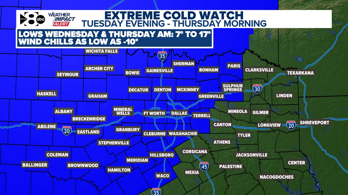
North Texans should prepare for the coldest air of the season this week as an Arctic front arrives Tuesday afternoon.
DALLAS — Watch live radar and forecast updates on the WFAA+ streaming app and download the WFAA app for alerts from our team.
North Texans should brace for dangerous cold as the coldest air of the season is set to move in midweek.
Key takeaways
- Dangerous cold this week
- Arctic cold front arrives Tuesday afternoon
- A light wintry mix possible Tuesday night – Wednesday morning
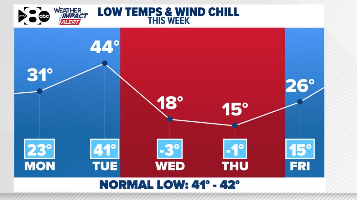
An arctic blast takes over midweek!
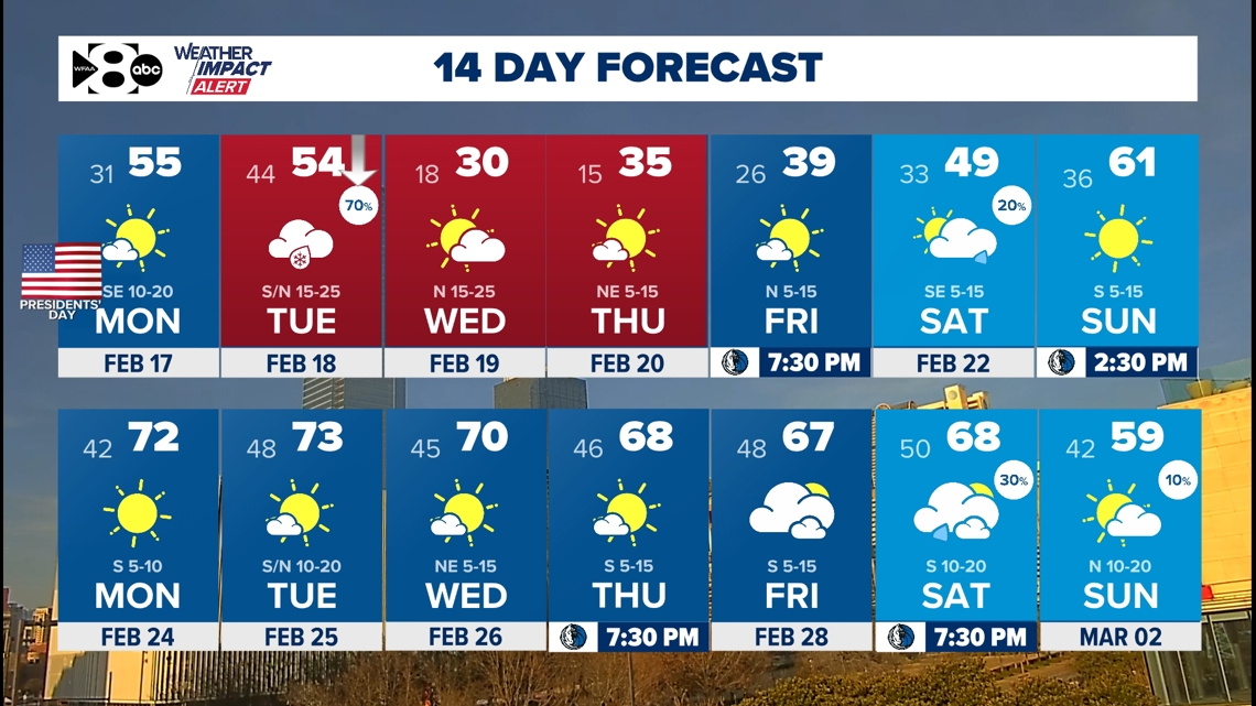
Saturday we hit 72° and Sunday we stayed in the 40s. That’s not even close to as cold as it will get this week, so brace yourselves! In preparation for the dangerous cold, an extreme cold watch has been issued for the area for single-digit lows and below-zero wind chills for many.

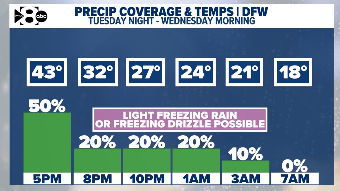
More on the cold in a moment. Let’s talk about our chances for wintry precip real quick.
Wintry precipitation chances are low
Here’s what we know:
- A strong, Arctic cold front arrives Tuesday and it interacts with this moisture to produce rain and isolated thunderstorms during the day Tuesday.
- Temperatures drop quickly on Tuesday night while moisture is still around. This is when we could see a brief transition to light freezing rain or freezing drizzle. Slick spots on bridges and overpasses will be the main concern. Overall, the threat of icing is very low.
Again, at this time, the chance for light freezing rain & freezing drizzle is low. But as temps drop below freezing Tuesday night, there may be just enough left over to create a few slick spots mainly on bridges & overpasses. Most of the rain should be done before dropping below 32°!

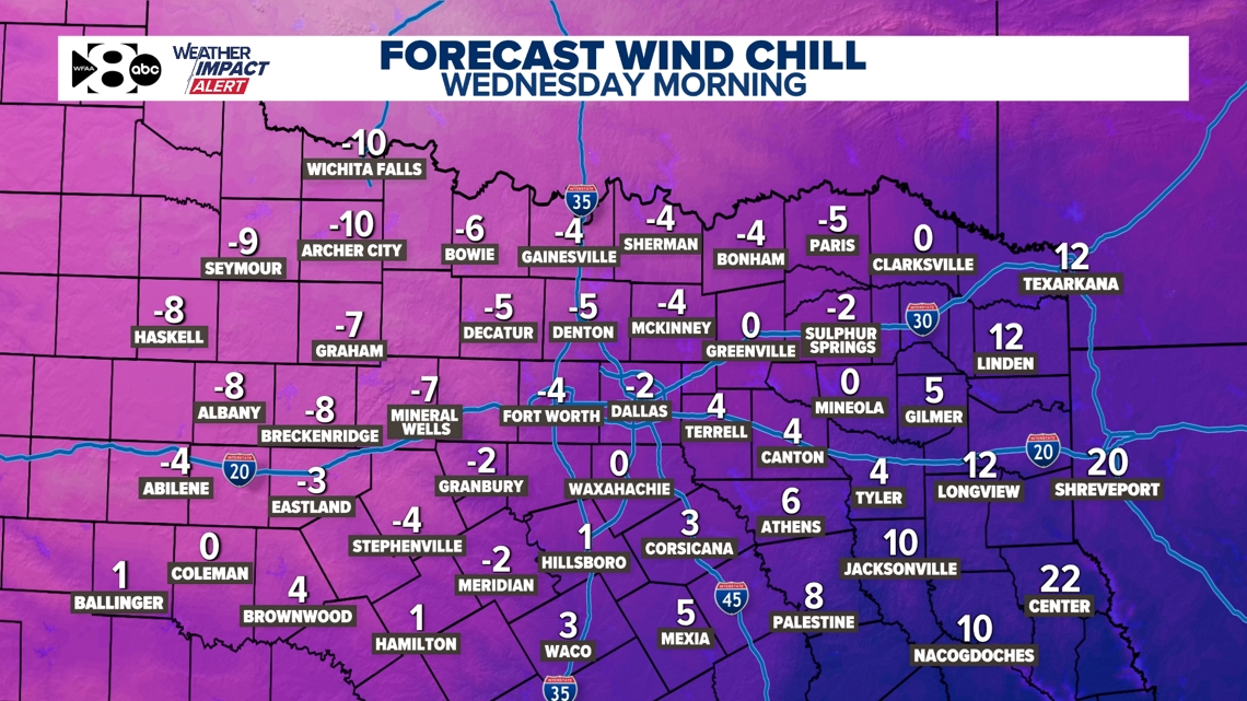
The Arctic front brings in the coldest air of the season. Temperatures will fall into the teens and single digits areawide both Wednesday morning and Thursday morning. Add in a strong northerly breeze with gusts up to 30mph, especially Wednesday morning, and wind chills will plummet well below zero. The coldest of the cold will be northwest of Fort Worth, where some wind chills could be as cold as -10°. This is pipe-bursting cold, so please make sure you are taking all the necessary precautions and preparations.

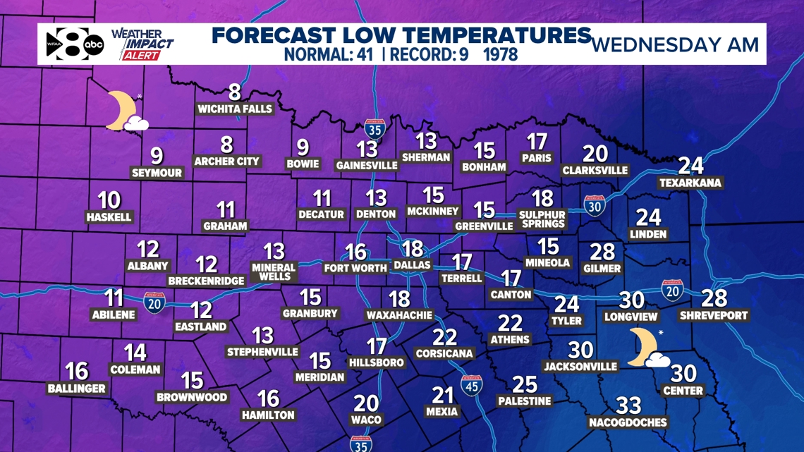

Thursday’s winds won’t be quite as strong, but it will be just as cold, if not colder. The only thing the relatively calmer winds will help is the wind chill. Do not get me wrong, it will still be dangerously cold and wind chills will be below zero, but not quite as low as Wednesday morning.


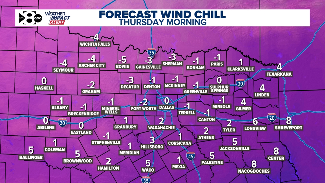
Do not forget the 4 Ps: people, pets, pipes, plants. We will spend nearly 2 days below freezing.

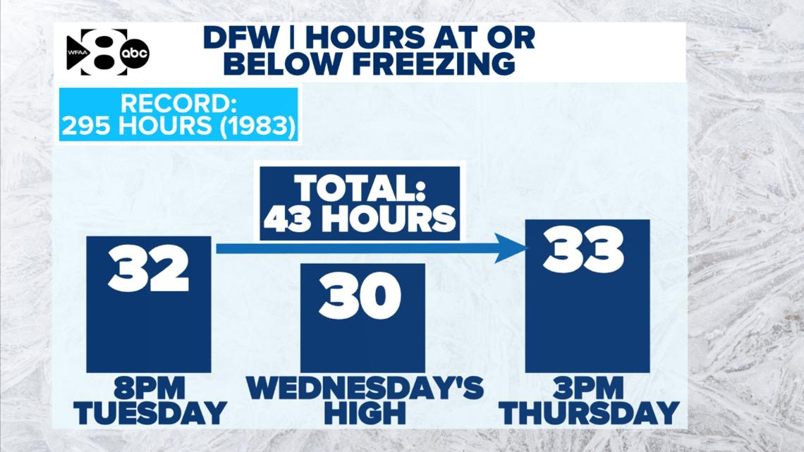
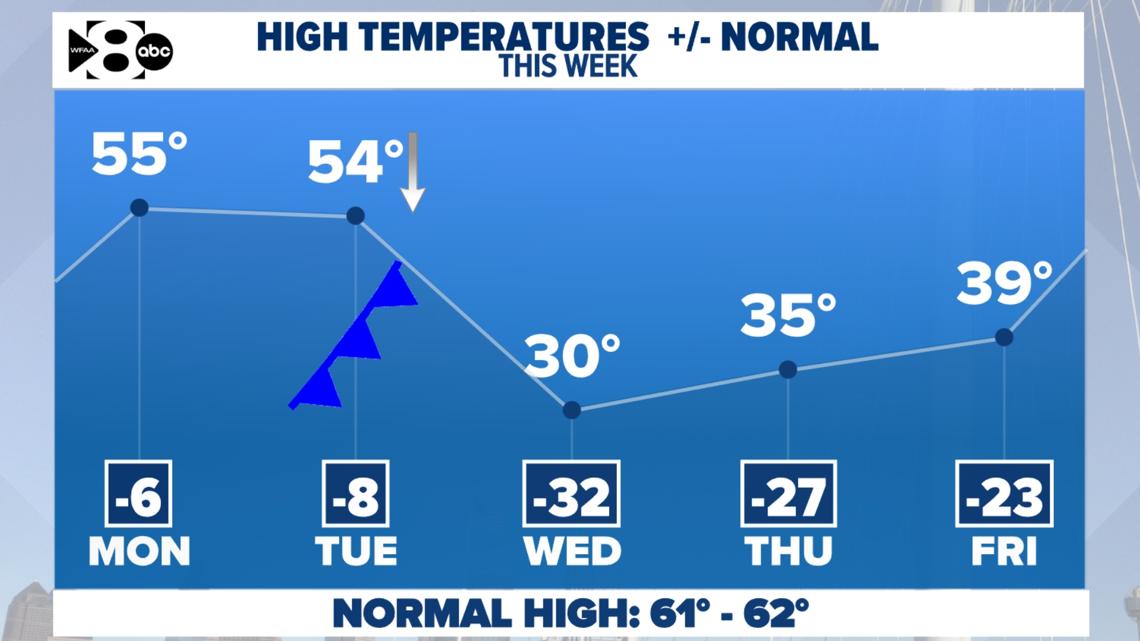
As you see above, temps crack freezing Thursday afternoon after dropping below freezing Tuesday night. But just barely… The highs on Thursday will be only in the middle 30s. We won’t get well above freezing until Friday afternoon. And don’t worry…. it gets much warmer than that for next weekend and the following week. In the meantime, you’ll have to deal with all of this cold weather this week.


14 Day
Spring returns the second half of the 14 day.