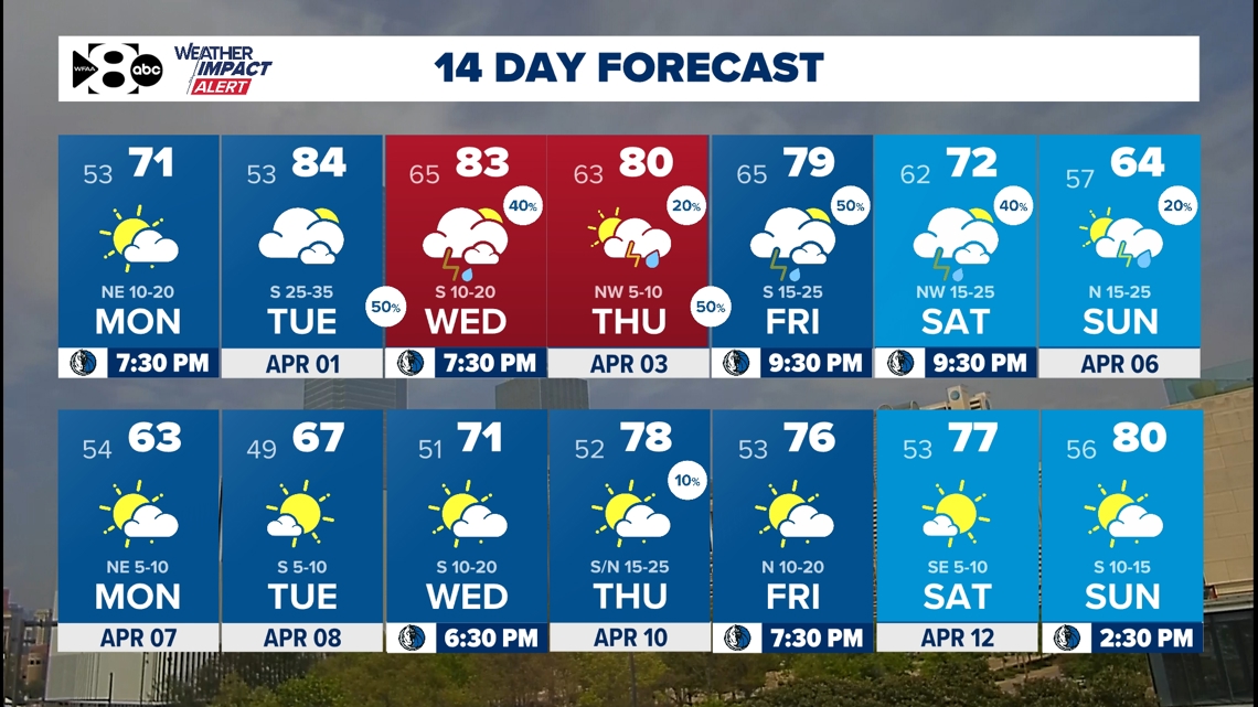
The weather is unsettled this week with numerous chances for thunderstorms.
We’re tracking the latest forecast and weather updates on the WFAA+ streaming app. Don’t have WFAA+? Here’s how to download and install the app on your smart TV.
Key takeaways
- WFAA Weather Alert Days for Wednesday and Thursday
- Stormy pattern ahead
- Severe weather possible
Enjoy Monday and Tuesday!
Both Monday and Tuesday look really nice in North Texas. They will be our only completely quiet days before we turn active and unsettled the rest of the week.
Several chances for thunderstorms this week
The pattern is looking unsettled this week with daily rain and storm chances beginning as early as overnight Tuesday night. We will have a series of storms this week with plenty of instability in the atmosphere to work with to produce strong to severe storms.
Don’t be surprised if more WFAA Weather Alert Days are issued this week. Monday and Tuesday afternoon will be the only quiet days we have this week. Conditions are looking cooler and more stable as we get to the second half of the 14-day forecast.

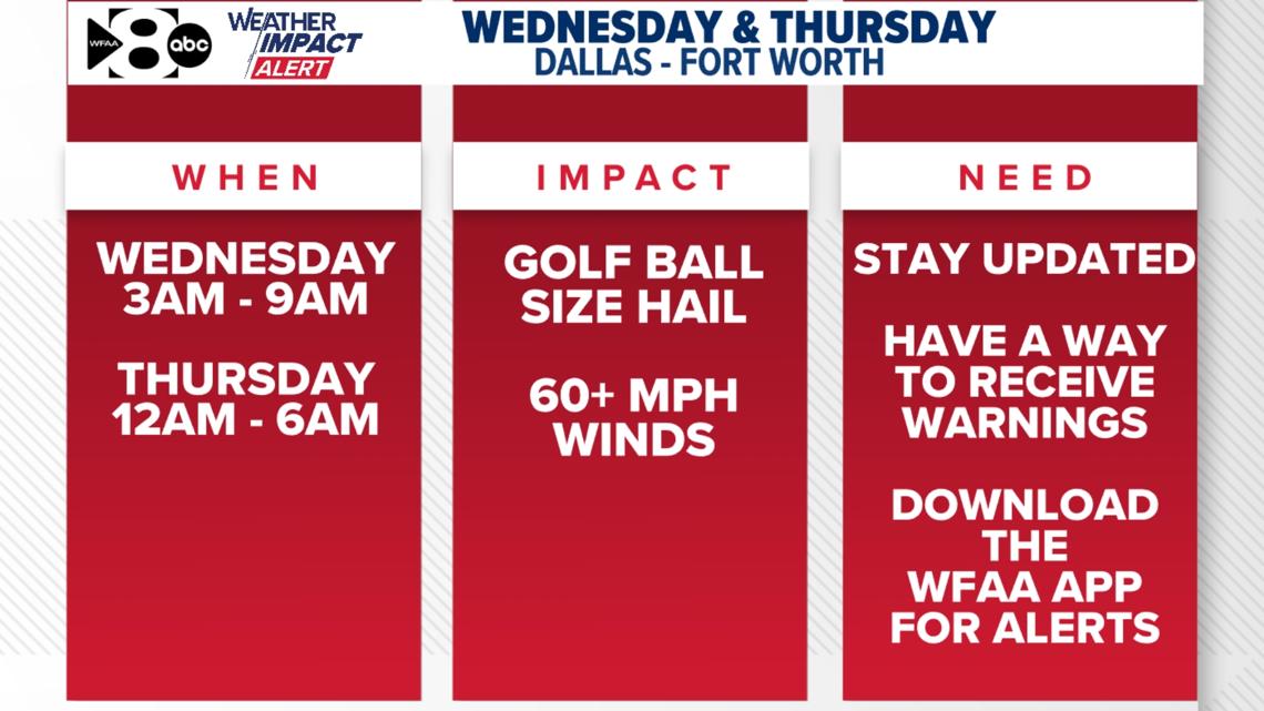
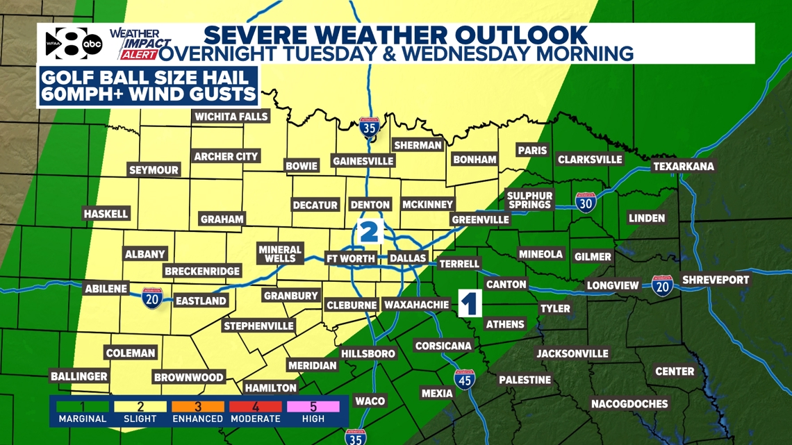
Overnight Tuesday (after 3 a.m.) and Wednesday morning
Up to golf ball size hail & some 60+ mph wind gusts will be possible in a few storms overnight Tuesday (after 3 a.m.) into Wednesday morning. At this time, most of North Texas is included in a level 2/slight risk to reflect this potential. Prepare for some slowdowns early Wednesday morning with this chance of thunderstorms.

Overnight Tuesday and Wednesday morning TIMING:
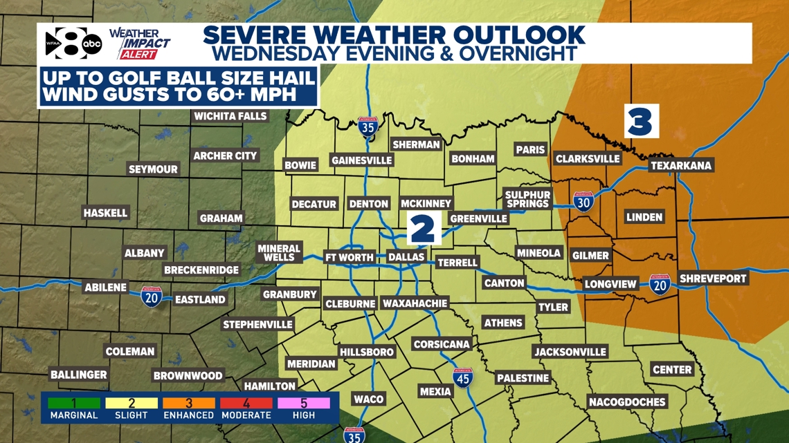
Wednesday’s risk:
The concerns remain the same. Up to golf ball size hail & some 60+ mph wind gusts will be possible in a few storms. The tornado threat on both days is very low, but not zero. That’s something we will closely monitor. After the round of morning storms comes to an end, much of Wednesday afternoon appears to be fairly quiet. The only exception will be east of the metroplex Wednesday afternoon where a few storms could intensify to severe.
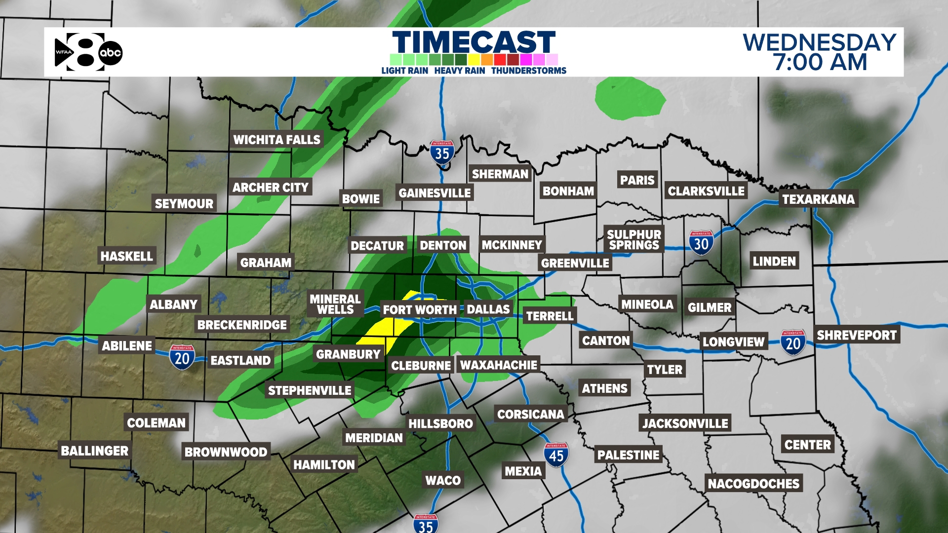
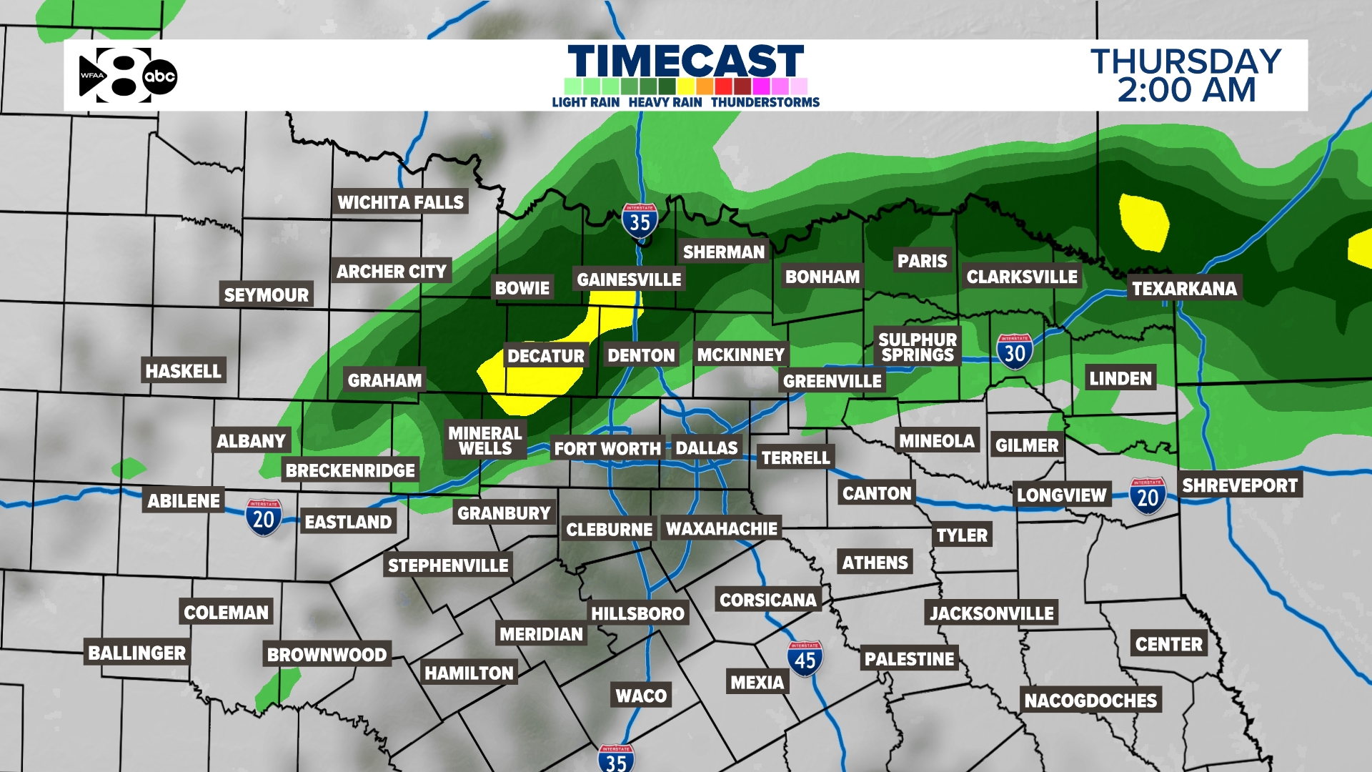
On Wednesday evening and overnight, the next round of thunderstorms could build back into the area. This may even linger into Thursday morning.

Wednesday timing:
We aren’t done there
Several additional rounds of thunderstorms are in the forecast to end the workweek and even into the weekend. Some of those could also be severe. At this time, there is no severe weather outlook for those days, but that’s likely to change. Please keep checking back to this article as we update timing, risks and add the additional chances in the days to come.