Severe weather and warmth to end 2024, but a cold front looms near New Year’s Eve.
DALLAS — Watch live radar and forecast updates on WFAA+ and download the WFAA app for alerts from our team.
Key takeaways:
-
Severe thunderstorms possible Thursday
-
Warmer than normal through 2024
-
A cold front in time for NYE
Severe weather potential Thursday
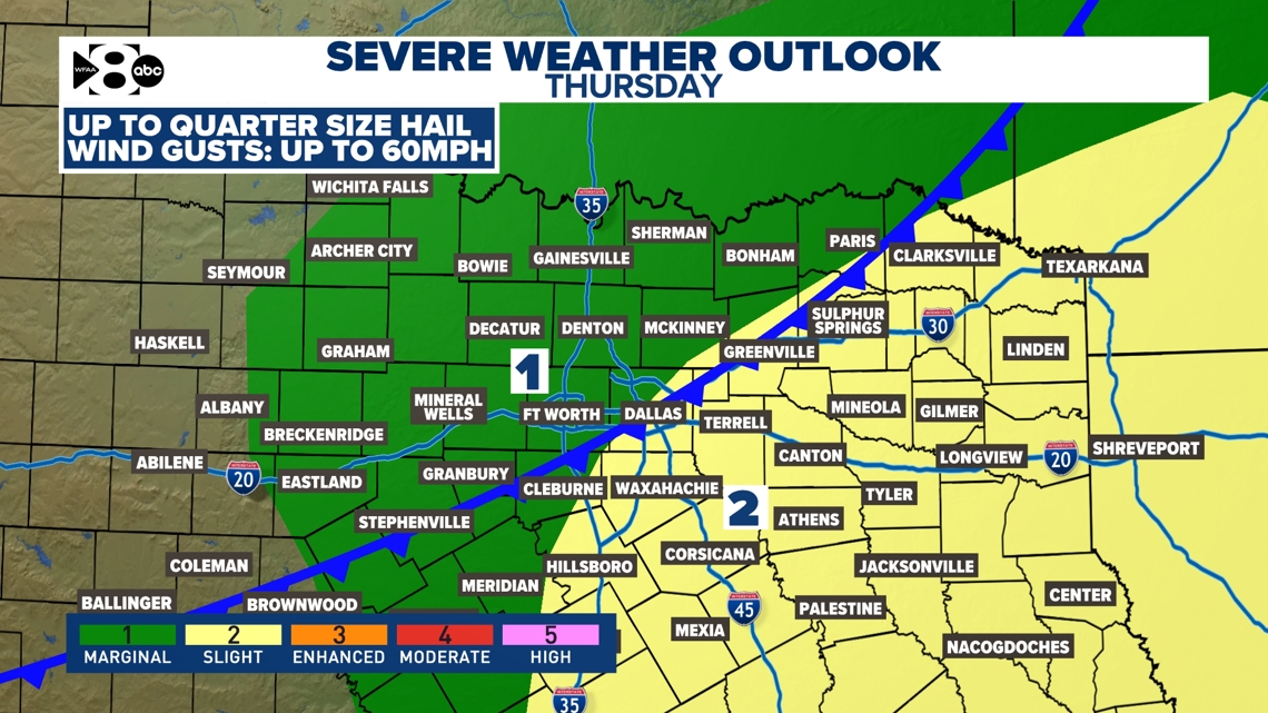
Another round of widespread showers and storms is likely on Thursday mainly during the late morning and afternoon hours. Once again, the overall severe threat looks low for most, but we will continue to monitor. There could be a chance for some strong to severe storms in the eastern half of North Texas and into East Texas with a wind and hail threat. The tornado threat is not completely zero as a brief spin-up could be possible as well. Here’s the latest severe weather outlook


Timeline:
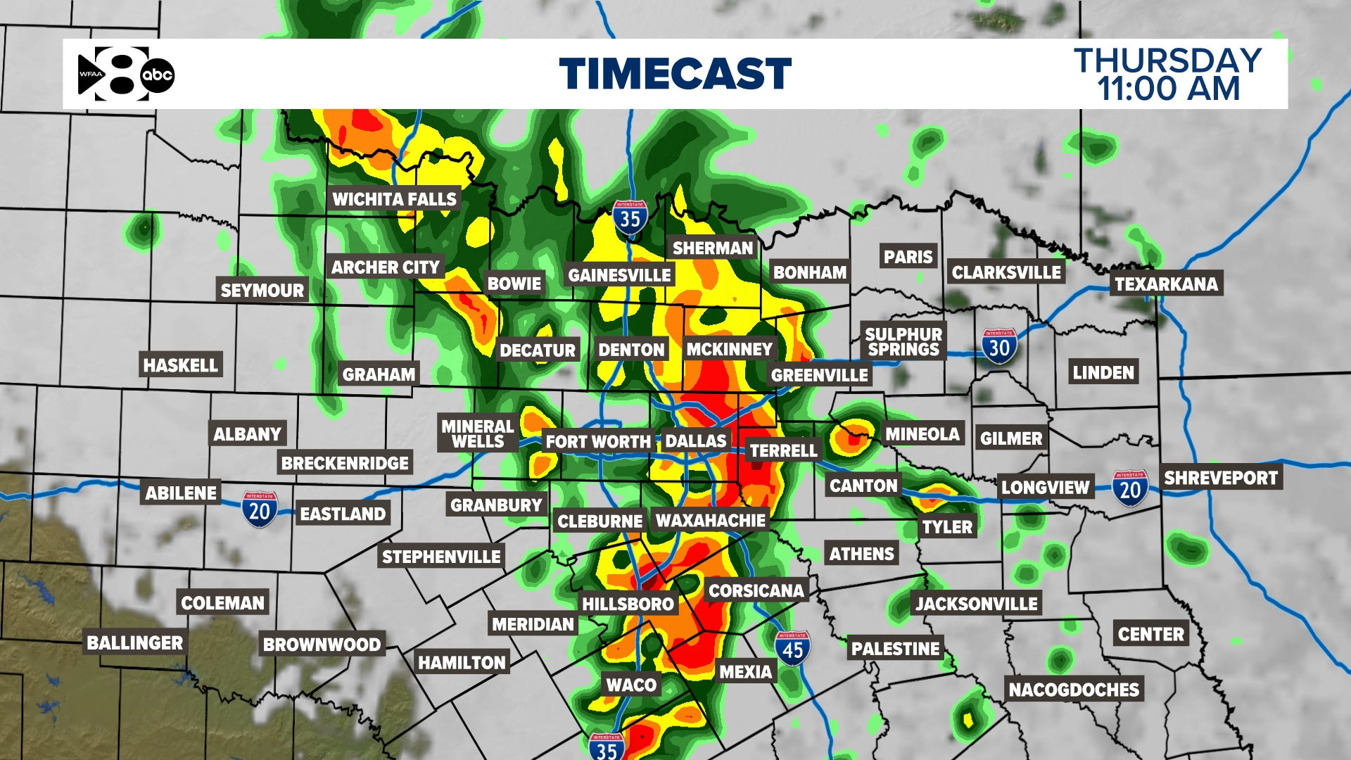
Below you’ll see an hour-by-hour timeline of the rain and thunderstorm activity on Thursday. Rain coverage increases throughout Thursday morning with stronger storms possible near midday. By that time, most of the activity is already pressing east of the metroplex where there will be a better chance for a few strong to severe storms through the afternoon.
Temperatures
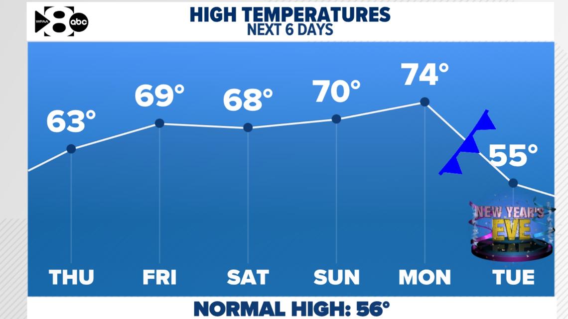
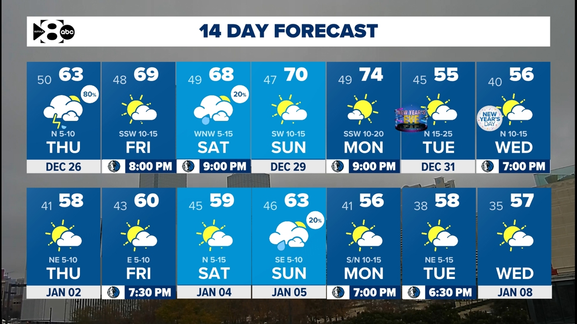
The trend for most of the remainder of 2024 is up. High temperatures are expected to be warmer than normal to wrap up 2024. However… the very last day, when it matters the most for outdoor activities… a cold front looks to sweep through and knock us down to cooler, but closer to normal, highs. The forecast highs on NYE at this time look to be in the middle 50s after highs in the 60s and 70s.


14 Day


