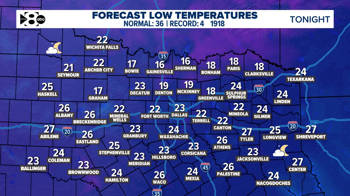
Black ice is a concern Saturday morning after melting and standing water on roads Friday.
DALLAS — Watch live radar and forecast updates on WFAA+ and download the WFAA app for alerts from our team.
Key Takeaways:
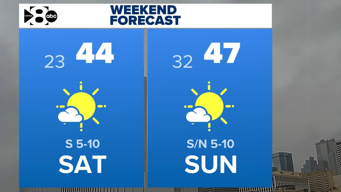
- This Weekend: Clear and cold, highs in the 40s with near or below-freezing
- Melting Risks: Daytime thawing, overnight refreezing. Black ice is likely especially Saturday morning.
- Next Week: Gradual warm-up with highs peaking at 64°F by Friday.
- Beyond: Arctic air may return
Weekend Overview
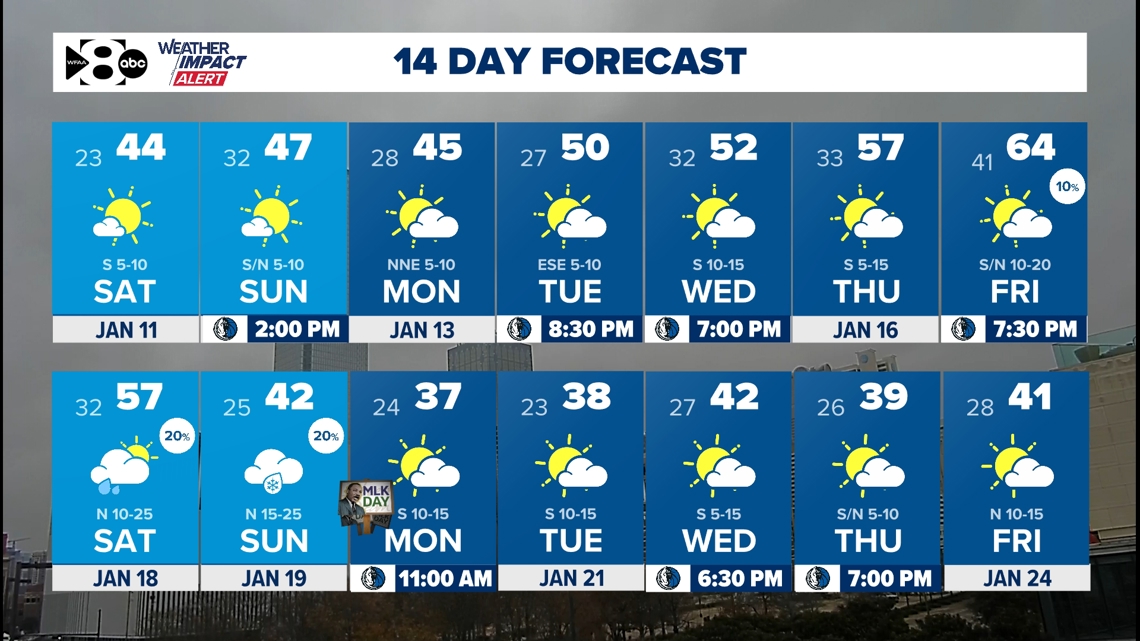
This weekend will be cold, but there’s a glimmer of sunshine to enjoy. Saturday starts chilly, with highs only reaching 44° under sunny skies. Sunday stays clear but barely warmer, topping out at 47°. This will allow for a lot of melting of the snow that fell Thursday and Friday.

Melting and Black Ice Concerns
We had a fair amount of melting on roads Friday. With temps falling well below freezing overnight, black ice is a concern not only overnight but early Saturday morning. Things will be totally fine by midday with temps climbing fast under a mostly sunny sky.

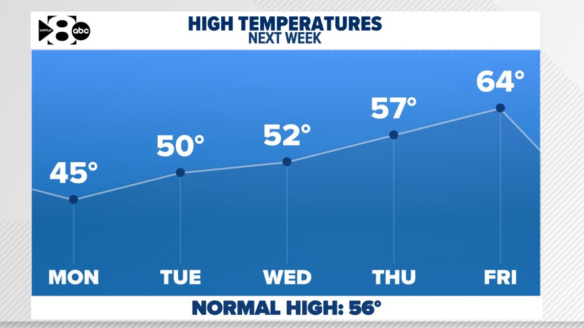
Brief Warm-Up Next Week
Relief from the cold comes midweek, with temperatures inching up to 57°F on Thursday and peaking at 64°F on Friday.
While Friday includes a slight chance of rain (10%), most of next week looks dry and sunny. This will feel like a reprieve, but the warm spell will be short-lived.

More Cold Air Ahead
By next weekend, a cold air may begin its return. Saturday’s high drops to 57°F, with strong north winds at 10-25 mph. Sunday looks even colder, with highs struggling to reach 42°F and a slight chance of a wintry mix (20%). It is EARLY. This forecast will be adjusted with time. See the 14 day below.
14 Day