Wind gusts close to 60 mph will be possible on Friday. This makes for difficult driving conditions, heightened fire danger, and an increase in blowing dust.
DALLAS — Powerful wind gusts are expected through the day Friday, especially in the afternoon. This will make for difficult driving conditions, heightened fire danger, and an increase in blowing dust. Sustained winds will be up to 35 mph while some wind gusts could approach 50-65 mph.
Here’s everything you need to know to stay prepared Friday, including the latest timing and impacts:

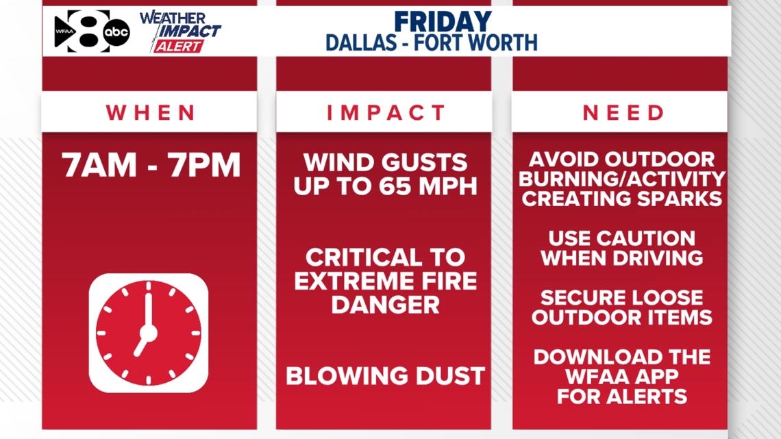
WHEN
Friday (7 a.m. to 7 p.m.).
Winds will be strong most of the day. Sustained winds will be up to 35 mph while some wind gusts could approach 50-65 mph.
IMPACT
High winds for an extended period can cause a few issues. A High Wind Watch is in place for Friday. Driving conditions will be difficult, especially for high-profile vehicles. High winds in addition to low humidity increase fire danger across the region. Critical to extreme fire threat will be in place across North Texas. A Fire Weather Watch is in place for parts of North Texas including DFW. This will likely be a Red Flag Warning which is issued when conditions are present that could easily start and spread fires. High winds will also cause dust to be blown into North Texas. This will likely cause allergy issues.
NEED
- Avoid outdoor burning or any activities that lead to sparks.
- Secure loose outdoor items.
- Use caution when driving, especially high-profile vehicles.
- Avoid the outdoors if sensitive to blowing dust.
Download the WFAA Weather App to stay on alert on the go and download WFAA+ for the latest updates.
