Isolated severe storms are possible after 4 p.m. Wednesday along and east of I-35. Here’s what you need to know
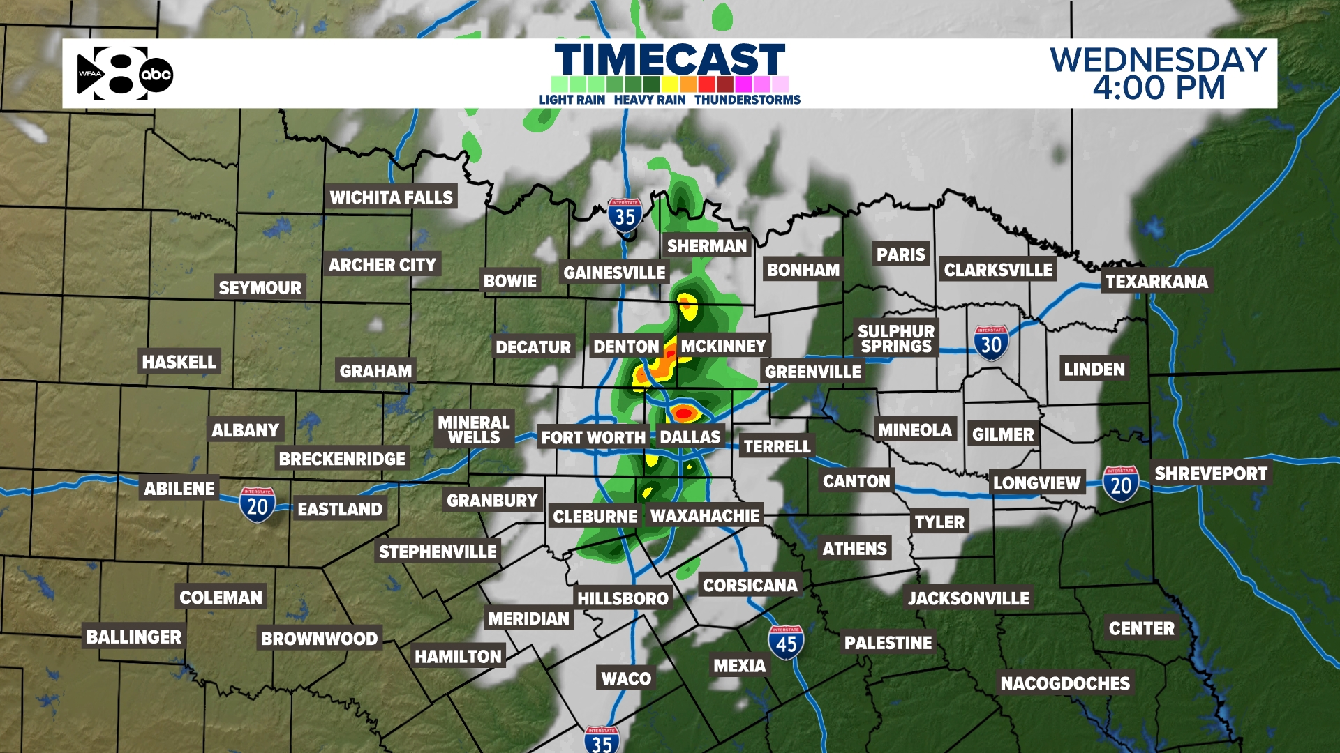
DALLAS — A storm system approaching from the west will usher in plenty of moisture to North Texas on Wednesday with the help of a gusty southerly wind, prompting a WFAA Weather Alert.
A dryline will form in our western counties and push toward I-35 Wednesday afternoon.

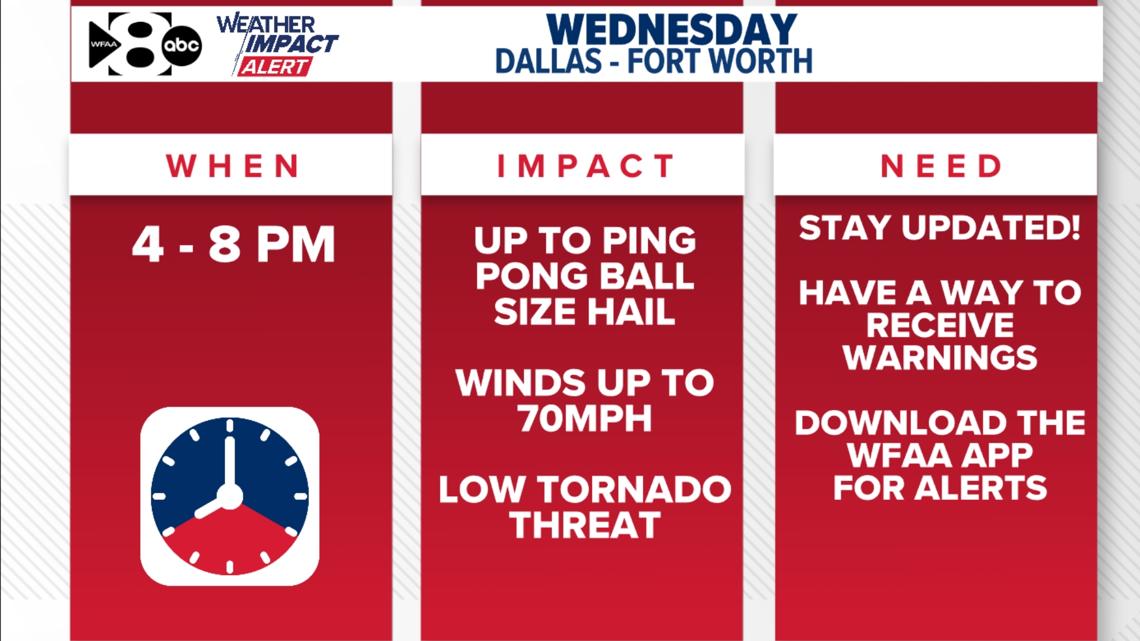
WHEN
Wednesday late afternoon (4 p.m.) through Wednesday evening (8 p.m.).
The latest data brings in a few isolated thunderstorms along and east of I-35 around 4 p.m. If storms do develop, they would quickly race to the east.
One thing we do have working in our favor is that there will be a fairly strong “cap” or “lid” in place. This is a layer of warm stable air that helps to prevent thunderstorm development. So for now, the coverage of storms still looks to be low.

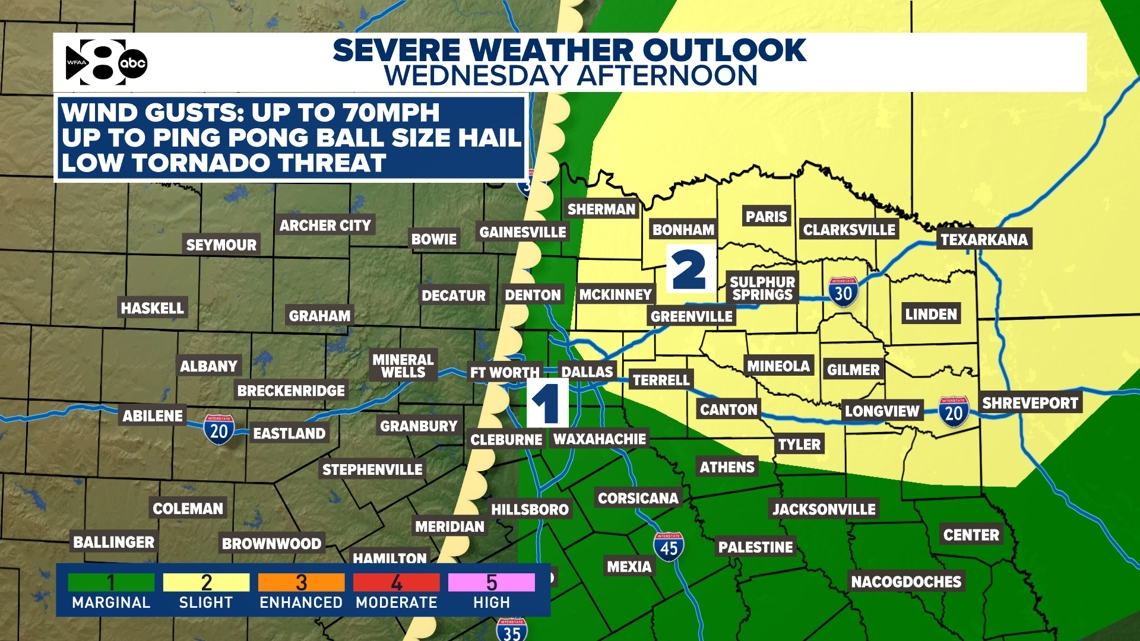
IMPACT
If storms do develop late Wednesday afternoon, they would be capable of up to ping-pong ball size hail, gusts to 70 mph, and a very low tornado threat.
NEED
Simply put, you just need to stay informed. Make sure you have a way to get warnings. You don’t want to get caught in rush hour if one of these storms develops.
Heavy rainfall will lower visibilities and hail could cause damage to your vehicle. Plan ahead!
