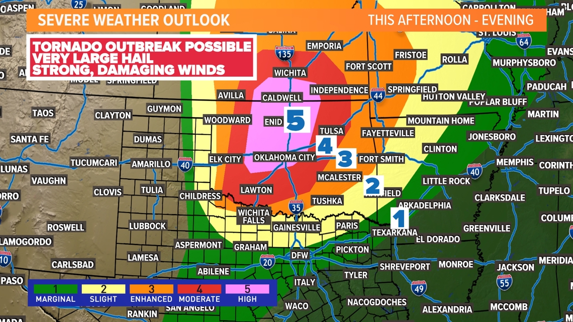
Monday brings a dangerous severe weather threat for parts of the plains.
DALLAS — Parts of Oklahoma and Kansas will likely see a severe weather outbreak Monday.
The Storm Prediction Center (SPC) has issued a very rare HIGH-RISK level for severe weather for parts of Oklahoma and Kansas. This is a level 5 out of 5, and it doesn’t happen often. The last time this was issued in the United States was March 31, 2023. That day, a total of 146 tornadoes were confirmed (one an EF-4) across 16 different states with multiple tornado emergencies issued. A tornado emergency is issued when a severe threat to human life and catastrophic damage is imminent or ongoing with a tornado.
What does that mean for Monday?
Today’s environment can sustain dangerous storms with several strong, long-lived tornadoes. Large hail up to softball size will be possible along with these storms. Wind gusts of 80 mph will also be possible with the strongest of storms.
This comes just days after a deadly tornado outbreak in Oklahoma claimed 4 lives.
The high risk includes a stretch of I-35 just south of Oklahoma City towards Wichita, Kansas. Storms will likely start around 4 p.m. and last into the overnight hours. Not everyone sees a storm in this area, but those that do will experience a dangerous storm. Avoid the area today and if you have friends or family in the area, make sure that they are paying attention!


Simply put, the cap.
A strong cap limits storm development in North Texas today. An elevated layer of stable air will keep storm coverage low. Thunderstorms will develop along a dryline to the west and those storms will move into a highly unstable atmosphere this afternoon and evening. Most of this activity is expected to stay north of the Red River. We will be watching for the potential of some of these storms to sneak into our far northern counties if the cap breaks.
As always make sure to have the WFAA App! It’ll help us alert you should the forecast change.