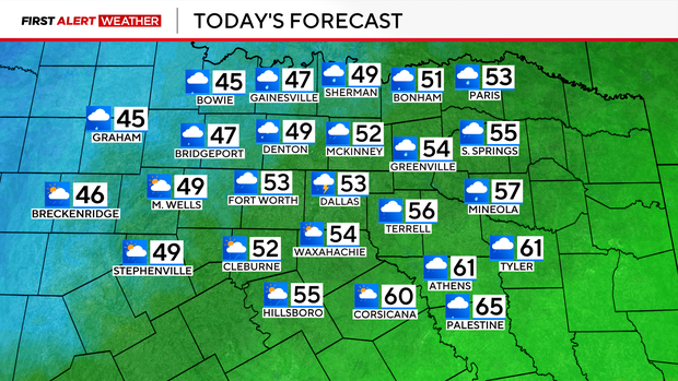
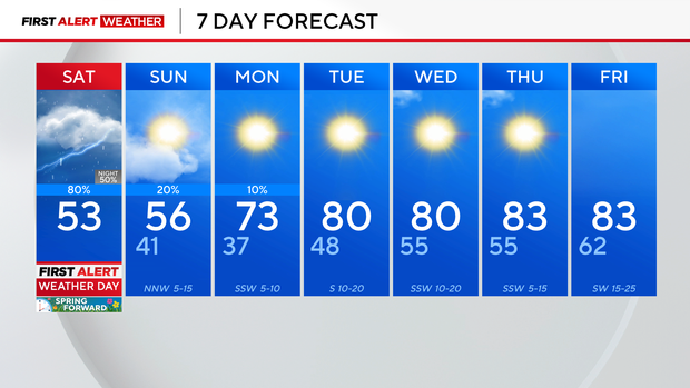
This weekend across North Texas, it will be cooler than earlier in the week, with rain chances lingering.
CBS News Texas meteorologists issued a First Alert Weather Day for Saturday due to the severe storm chances as well as a cold front that will drop temperatures by as much as 30 degrees from the day before.
CBS News Texas
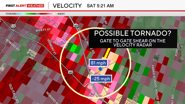
It was an active Saturday morning across parts of North Texas as two elevated supercell storms moved through. There were multiple severe thunderstorm warnings with large hail reported and damaging straight line winds.
Some areas had winds between 70-90 mph estimated by the local velocity radar. There could have been a tornado near Waxahachie Saturday morning, but it’s not yet confirmed. When the red and green on the velocity radar are right next to each other, that is an indication of rotation.
CBS News Texas
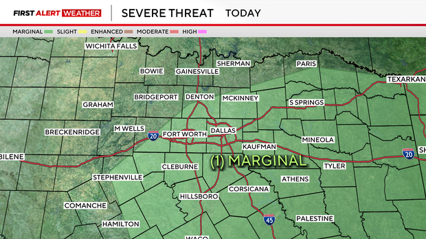
The risk of severe weather remains at a marginal risk Saturday, including the Dallas-Fort Worth Metroplex and counties to the southeast.
CBS News Texas
Keep the coats on and the umbrellas around – shower and storm chances are off and on throughout the day.
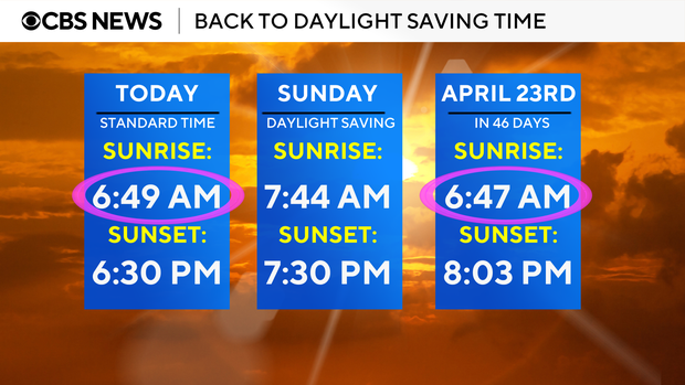
We lose an hour of sleep overnight as daylight saving time begins on Sunday.
CBS News Texas
Thankfully, next week is back to gorgeous weather with lots of sunshine on the way and highs in the 80s.
CBS News Texas

Featured Local Savings
