An Arctic Blast could bring the coldest air of the season and a little bit of a wintry mix to the area.
DALLAS — Tuesday, February 18th. Wednesday, February 19th and Thursday, February 20th are WFAA Weather Alert Days .
WHEN
Tuesday night, Wednesday and Thursday
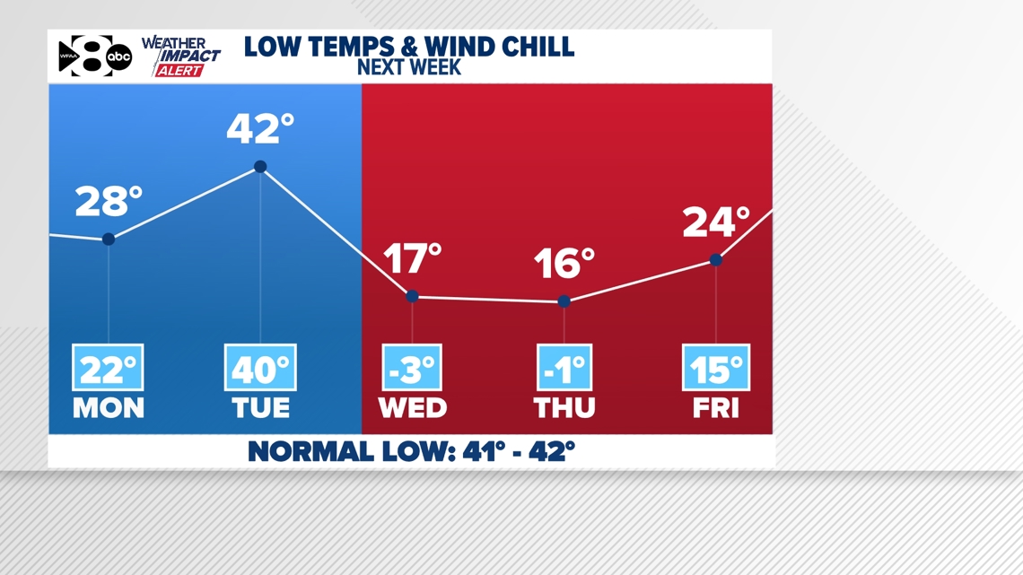
Rain Tuesday could transition into some light freezing rain or sleet Tuesday night into Wednesday as Arctic air spills into the area. Some light ice accumulation is possible. It’s too early for exacts, but overall this doesn’t appear to be a lot of ice. Just enough that you may need to prepare for slick and hazardous roads along with lows in the teens and wind chills below zero for some.

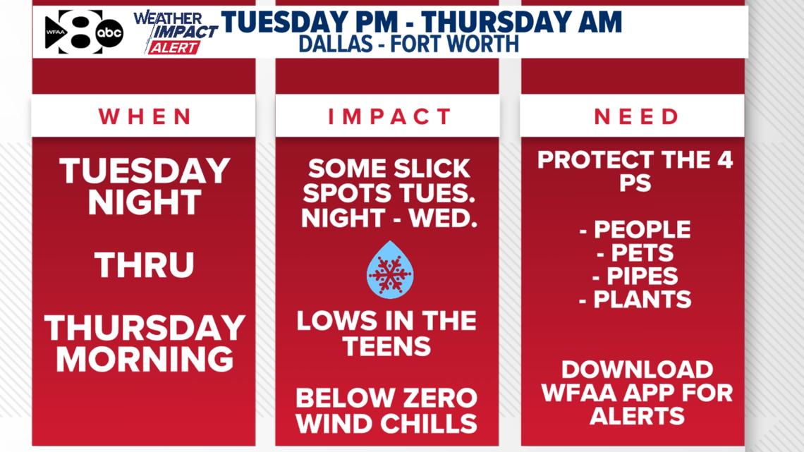
IMPACT
Roads could become slick especially late Tuesday night and Wednesday
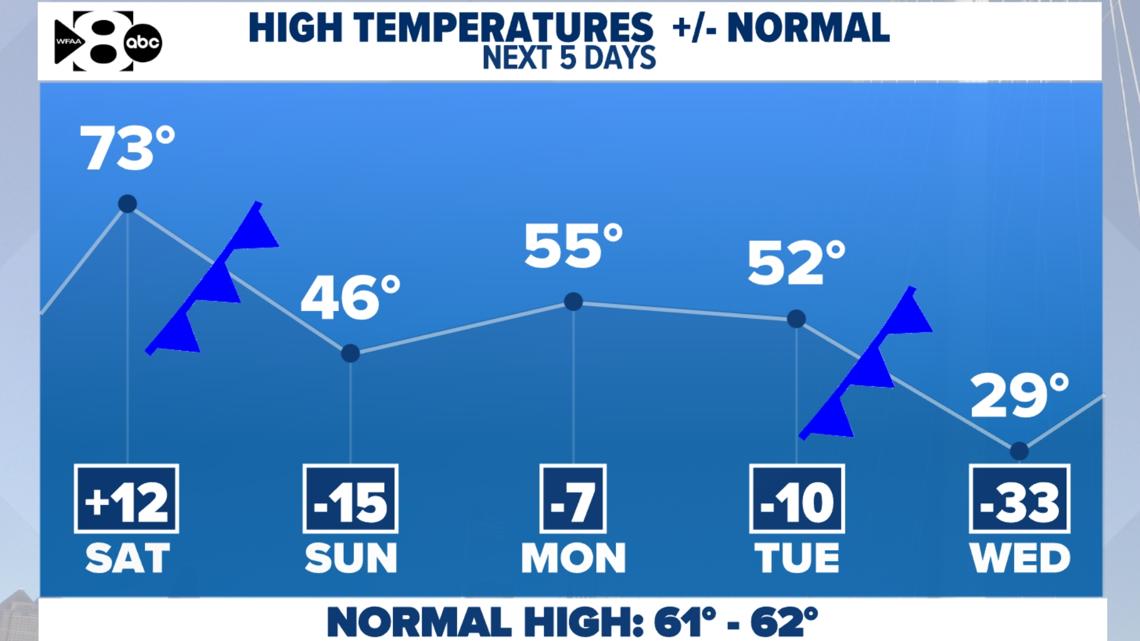
Also, we could be looking at the coldest air of the season! Lows Wednesday and Thursday morning will be in the teens with wind chills in the single digits. High temperatures both days will struggle to get to freezing.


NEED
Prepare for hazardous travel through Thursday Take your time if you have to be on the roads.
Stay updated on the forecast. The timing, ice amounts and impacts will be fine-tuned as we gather more data in the days to come.
